Bardala
| Bardala | |
|---|---|
| Other transcription(s) | |
| • Arabic | بردلة |
|
Bardala | |
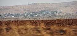
 Bardala Location of Bardala within the Palestinian territories | |
| Coordinates: 32°23′10.73″N 35°28′55.08″E / 32.3863139°N 35.4819667°ECoordinates: 32°23′10.73″N 35°28′55.08″E / 32.3863139°N 35.4819667°E | |
| Palestine grid | 195/199 |
| Governorate | Tubas |
| Founded | 1500 BC |
| Government | |
| • Type | Village council (from 1996) |
| Area | |
| • Jurisdiction | 20,000 dunams (20.0 km2 or 7.7 sq mi) |
| Population (2007) | |
| • Jurisdiction | 1,637 |
| Name meaning | "Berdeleh", a personal name[1] |
Bardala (Arabic: بردلة) is a Palestinian village in the northern Jordan Valley of the West Bank, consisting of 1,637 inhabitants. The town lies in the Tubas Governorate, located thirteen kilometers northeast of Tubas and 28 kilometers northeast of Nablus. The Israeli settlement of Mehola lies nearby.[2]
History
Bardala's history dates back to 1500 BCE.[3]
The main periods of settlement evidenced by archaeological excavation are the Byzantine, Early Islamic, Medieval, Ottoman and Modern ones; Roman-period finds were also present.[4] A Byzantine church was built here around the year 400.[5] On top of the remains of the church, of which the mosaic floor and column bases were excavated, stood a bathhouse from the Early Islamic period.[4]
The name Bardala derives from Bardaweel — the name of a prince who ruled the area in ancient times.[3] In the town lies a palace named after him.[3]
Bardala's water reservoirs are known to be the oldest in the Jordan Valley.[3] Other archaeological sites include tombs from various periods.[3] The al-Khader shrine is the oldest building in the village.[3]
The residents of Bardala originally came from nearby Tubas to exploit its cultivable and grazing land,[3] and in 1882, the Palestine Exploration Fund's Survey of Western Palestine described the village as "though ruined, is inhabited in spring by peasants from the hill villages, who descend to find pasture and to cultivate melons and other vegetables round the springs."[6]
In 1945, the population of Bardala was counted with that of Tubas and Kashda, according to an official land and population survey.[7] The population surged after the 1948 Arab–Israeli War, which left many Palestinians homeless in the wake of the destruction of nearby villages.[3]
Archaeologists have discovered evidence of an abundance of ground water resources in the area in ancient times. After Israel conquered the area in the 1967 Six-Day War, the village was connected to the Israeli water grid.[3] During the Second Intifada, the residents of Bardala stopped paying both water and electricity bills to the Palestinian National Authority, and, as a consequence the Palestinian authorities have delayed implementing infrastructural works, such as a dam and a water network for the village.[2] Israel placed restrictions on villagers' movements at the same time, rendering access to their lands to cultivate or harvest crops impossible. Since 2000, 200 dunams of vegetable crops have been bulldozed and many trees uprooted, and 4,000 dunams have been confiscated.[3]
In March 2012, a UN report listed the spring Ein El Azut, belonging to Bardala, among a number of springs which had been illegally taken over by Israeli settlers. Local Palestinians had formerly used the spring for irrigation and livestock.[8]
Geography and climate
Bardala is located in the Jordan Valley, at the foot of the hills rising west and southwest of it.[3] Immediately north of Bardala stretches the Green Line which marks the border between the West Bank and Israel, and behind it lies the plain of Beit She'an/Beisan,[3] which connects westwards to the Jezreel Valley. The elevation of Bardala is 71 meters below sea level. Nearby towns and villages include Tubas to the southwest and Ein al-Beida to the east.[3] Bardala's jurisdiction covers an area of 20,000 dunams, making up 4% of the Tubas Governorate lands.[3] The built-up area of the town is 480 dunams, while 10,000 dunams are classified as agricultural land and 400 dunams have been confiscated by Israeli authorities.[3]
Warm climate is characteristic of the town, with hot and dry summers and cold and dry winters. The average rainfall is 293 millimeters and the average annual temperature was 21 to 22 degrees Celsius. The average humidity rate is 55%.[3]
Demographics
In 1961, Bardala had a population of 367 inhabitants which decreased to 271 in 1982 due to emigration. The population nearly doubled to 457 five years later.[9] The entire population of Bardala comprises 3.3% of the governorate's population.[3]
According to a 1997 census by the Palestinian Central Bureau of Statistics (PCBS), the town's residents numbered 1,148, of which 566 were males and 582 were females. The age distribution was 49.3% between infancy and 14, 30.4% between the ages of 15 and 29, 22.8% between the ages of 30-64 and 2.8% were above the age of 65.[10]
In the 2007 census by the PCBS, Bardala had a population of 1,637.[11]
Over 90% of its inhabitants belong to the town's original inhabitants, the Swafta family. The remaining 10% are refugees from towns near Beit She'an in present-day Israel and Bedouins.[3]
References
- ↑ Palmer, 1881, p. 199
- 1 2 Isabel Kershner, Strategic Corridor in West Bank Remains a Stumbling Block in Mideast Talks,', New York Times, 4 January 2014.
- 1 2 3 4 5 6 7 8 9 10 11 12 13 14 15 16 17 18 Bardala Village Profile Applied Research Institute - Jerusalem.
- 1 2 Raphael Greenberg and Adi Keinan, Israeli Archaeological Activity in the West Bank 1967-2007: A Sourcebook, p. 36. Ostracon, 2009, ISBN 978-965-91468-0-2.
- ↑ Gunter Stemberger, Jews and Christians in the Holy Land: Palestine in the Fourth Century, p. 70. Bloomsbury T&T Clark, 2000, ISBN 978-0567086990.
- ↑ Conder and Kitchener, 1882, p. 227
- ↑ Government of Palestine, Department of Statistics. Village Statistics, April, 1945. Quoted in Hadawi, 1970, pp. 61, 108, 158
- ↑ How disposession happens; the humanitarian impact of the takeover of Palestinian water springs by Israeli settlers, the UN March 2012, p. 24
- ↑ Welcome to Bardala PalestineRemembered.
- ↑ Palestinian Population by Locality, Sex and Age Groups in Years Palestinian Central Bureau of Statistics.
- ↑ 2007 PCBS Census. Palestinian Central Bureau of Statistics. p.106.
Bibliography
| Wikimedia Commons has media related to Bardala. |
- Conder, Claude Reignier; Kitchener, H. H. (1882). The Survey of Western Palestine: Memoirs of the Topography, Orography, Hydrography, and Archaeology. 2. London: Committee of the Palestine Exploration Fund.
- Dauphin, Claudine (1998). La Palestine byzantine, Peuplement et Populations. BAR International Series 726 (in French). III : Catalogue. Oxford: Archeopress. ISBN 0-860549-05-4. (p. 790)
- Hadawi, Sami (1970). Village Statistics of 1945: A Classification of Land and Area ownership in Palestine. Palestine Liberation Organization Research Center.
- Palmer, E. H. (1881). The Survey of Western Palestine: Arabic and English Name Lists Collected During the Survey by Lieutenants Conder and Kitchener, R. E. Transliterated and Explained by E.H. Palmer. Committee of the Palestine Exploration Fund.
External links
- Welcome To Bardala
- Survey of Western Palestine, Map 12: IAA, Wikimedia commons
- Bardala (Fact Sheet), The Applied Research Institute - Jerusalem. February, 2006
- Bardala village profile, The Applied Research Institute - Jerusalem
| Cities |
|  |
|---|---|---|
| Municipalities | ||
| Villages |
| |
| Refugee camps | ||