Basudih
| Basudih বাসুডিহ बासुडिह | |
|---|---|
| Village | |
 Basudih  Basudih Location in Jamtara, Jharkhand | |
| Coordinates: 23°58′59″N 87°06′09″E / 23.98298°N 87.10255°ECoordinates: 23°58′59″N 87°06′09″E / 23.98298°N 87.10255°E | |
| Country |
|
| State | Jharkhand |
| District | Jamtara |
| Founded by | Shree Brajamohan Maji |
| Area | |
| • Total | 5 km2 (2 sq mi) |
| Elevation | 155 m (509 ft) |
| Population (2001) | |
| • Total | 500 |
| • Density | 100/km2 (300/sq mi) |
| Languages | |
| • Official | Bangla, Hindi, English, Santali |
| Time zone | IST (UTC+5:30) |
| PIN | 815359 |
| Telephone code | 06428 |
| Vehicle registration | JH-21 |
| Sex ratio | 959 ♂/♀ |
| Website |
www |
Basudih (Bengali: বাসুডিহ) is a village in Nala block, Jamtara district, Jharkhand state, India has a Population (2001 Census) of 500 in about 50 families.
Demographics
As of 2001 India census, Basudih had a population of 500. Males constitute 51% of the population and females 49%. Basudih has an average literacy rate of 71%, higher than the national average of 59.5%, male literacy is 78%, and female literacy is 62%. In Basudih, 12% of the population is under 6 years of age.
Climate
Basudih has a humid subtropical climate (Köppen climate classification Cwa), with warm, wet summers and mild winters.
| Climate data for Basudih | |||||||||||||
|---|---|---|---|---|---|---|---|---|---|---|---|---|---|
| Month | Jan | Feb | Mar | Apr | May | Jun | Jul | Aug | Sep | Oct | Nov | Dec | Year |
| Record high °C (°F) | 33.3 (91.9) |
35.6 (96.1) |
42.8 (109) |
46.3 (115.3) |
48.3 (118.9) |
45.2 (113.4) |
41.5 (106.7) |
38.6 (101.5) |
38.1 (100.6) |
37.6 (99.7) |
35.8 (96.4) |
31.2 (88.2) |
48.3 (118.9) |
| Average high °C (°F) | 25.9 (78.6) |
28.9 (84) |
34.3 (93.7) |
38.4 (101.1) |
37.5 (99.5) |
35.5 (95.9) |
32.7 (90.9) |
32.5 (90.5) |
32.9 (91.2) |
33.0 (91.4) |
30.5 (86.9) |
27.0 (80.6) |
32.42 (90.36) |
| Average low °C (°F) | 10.2 (50.4) |
13.2 (55.8) |
17.4 (63.3) |
22.3 (72.1) |
23.9 (75) |
24.7 (76.5) |
24.1 (75.4) |
23.7 (74.7) |
23.6 (74.5) |
21.0 (69.8) |
16.0 (60.8) |
11.1 (52) |
19.27 (66.69) |
| Record low °C (°F) | 1.7 (35.1) |
1.8 (35.2) |
5.8 (42.4) |
13.8 (56.8) |
14.5 (58.1) |
17.8 (64) |
13.4 (56.1) |
16.8 (62.2) |
13.8 (56.8) |
11.8 (53.2) |
4.8 (40.6) |
2.8 (37) |
1.7 (35.1) |
| Average precipitation mm (inches) | 9.0 (0.354) |
15.0 (0.591) |
21.0 (0.827) |
35.0 (1.378) |
72.0 (2.835) |
198.0 (7.795) |
343.0 (13.504) |
293.0 (11.535) |
273.0 (10.748) |
116.0 (4.567) |
9.0 (0.354) |
7.0 (0.276) |
1,391 (54.764) |
| Average rainy days | 1.5 | 2.3 | 2.2 | 2.8 | 6.3 | 11.3 | 18.9 | 16.9 | 14.1 | 5.7 | 1.1 | 0.8 | 83.9 |
| Source: NOAA (1971-1990) [1] | |||||||||||||
Education
Primary School Basudih
- Address - Basudih, Jamtara, Jharkhand, Postal Code: 815359 India
- Cluster Name - Ums Khuriyam
- Block Name - Nala
- School Type - Co-Educational
- School Category - Primary Only
- School Management - Department of Education
- Mid-Day Meal - Provided and Prepared in School Premises
- Medium of Instruction - Hindi
- Founded In Year - 1958
- Location Type - Rural
- School Building Type - Government Building
- No. of Books in Library - 210
- No. of Computers - Not Specified
- No. of Class Rooms - 2
- No. of Teachers - 1
- Classes Class - 1 to 5
- Drinking Water Type - Hand-Pump
- Playground ✖
- Books Library ✔
- Residential Facility ✖
- Pre-Primary Section ✖
- Medical Check-Up ✔
- Computer Aided Learning ✖
- Ramps for Disabled ✖
- CCE Curriculum ✔
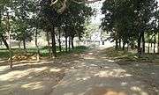
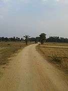
Gallery
| Images of different places in Basudih | ||||||||||||||||||||||||||||||
|---|---|---|---|---|---|---|---|---|---|---|---|---|---|---|---|---|---|---|---|---|---|---|---|---|---|---|---|---|---|---|
|


Facebook Page
References
- ↑ "Basudih Climate Normals 1971-1990". National Oceanic and Atmospheric Administration. Retrieved December 22, 2012.
External links
See also
This article is issued from Wikipedia - version of the 9/23/2016. The text is available under the Creative Commons Attribution/Share Alike but additional terms may apply for the media files.