Batabanó, Cuba
| Batabanó | |
|---|---|
| Municipality | |
 | |
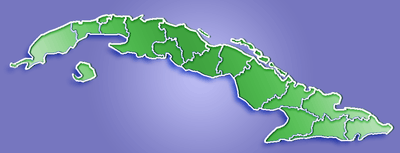
.png) Batabanó municipality (red) within Mayabeque Province (yellow) and Cuba | |
 Location of Batabanó in Cuba | |
| Coordinates: 22°41′55″N 82°17′38″W / 22.69861°N 82.29389°WCoordinates: 22°41′55″N 82°17′38″W / 22.69861°N 82.29389°W | |
| Country |
|
| Province | Mayabeque |
| Founded | 1688[1] |
| Established | 1898 (Municipality) |
| Area[2] | |
| • Total | 187 km2 (72 sq mi) |
| Elevation | 5 m (16 ft) |
| Population (2004)[3] | |
| • Total | 25,664 |
| • Density | 137.2/km2 (355/sq mi) |
| Time zone | EST (UTC-5) |
| Area code(s) | +53-7 |
| Location |
Batabanó Cuba |
|---|---|
| Coordinates | 22°41′15.7″N 82°17′51.8″W / 22.687694°N 82.297722°W |
| Year first constructed | 1847 (first) |
| Tower shape | small lantern structure atop a water tank |
| Markings / pattern | white water tank |
| Height | 28 metres (92 ft) |
| Focal height | 31 metres (102 ft) |
| Light source | mains power |
| Range | 7 nautical miles (13 km; 8.1 mi) |
| Characteristic | Fl W 10s. |
| Admiralty number | J5166 |
| NGA number | 13647 |
| Cuba number | CU-1165[4] [5] |
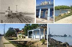
Batabanó is a municipality and town in the Mayabeque Province of Cuba. It was founded in 1688.[1]
Overview
The municipality is crossed by a number of small rivers, among them Río Guanabo, Río San Felipe, Río Pacheco, Río San Juan and Río Santa Gertrudis. A marina is located in the port of Batabanó (Surgidero de Batabanó). This port is dated back to the 16th century and functioned as the south port of Havana for the coastline navigation to other Cuban cities before the railroad connected all the country in the 19th century. Nowadays is the main port for the communication to Isla de la Juventud (to the port of Nueva Gerona) and Cayo Largo del Sur with ferryboat and passenger regular services, as well as, an important fishing port.
The Batabano cays, developed in the sea south of the community are part of the Canarreos Archipelago.
Demographics
In 2004, the municipality of Batabanó had a population of 25,664.[3] With a total area of 187 km2 (72 sq mi),[2] it has a population density of 137.2/km2 (355/sq mi).
The municipality is divided into the barrios of Pueblo de Batabanó, Surgidero, Camacho, Pozo Redondo, La Julia and Sopapo.[1]
See also
- List of lighthouses in Cuba
- Gulf of Batabanó
- Batabanó Municipal Museum
- Municipalities of Cuba
- List of cities in Cuba
References
- 1 2 3 Guije.com. "Batabanó" (in Spanish). Archived from the original on 13 October 2007. Retrieved 2007-10-07.
- 1 2 Statoids (July 2003). "Municipios of Cuba". Archived from the original on 12 October 2007. Retrieved 2007-10-07.
- 1 2 Atenas.cu (2004). "2004 Population trends, by Province and Municipality" (in Spanish). Archived from the original on 2007-09-27. Retrieved 2007-10-07.
- ↑ Cuba The Lighthouse Directory. University of North Carolina at Chapel Hill. Retrieved 8 September 2016
- ↑ List of Lights, Buoys and Fog Signals Atlantic Coast. Retrieved 8 September 2016
External links
| Wikimedia Commons has media related to Batabanó. |