Battle Creek (California)
| Battle Creek | |
| River | |
 Battle Creek | |
| Country | United States |
|---|---|
| State | California |
| Tributaries | |
| - left | South Fork Battle Creek, Spring Branch Battle Creek |
| - right | North Fork Battle Creek |
| Source | Confluence of North Fork and South Fork |
| - location | Near Manton, California |
| - elevation | 868 ft (265 m) |
| - coordinates | 40°25′23″N 121°59′49″W / 40.42306°N 121.99694°W |
| Mouth | Sacramento River |
| - location | Southeast of Anderson |
| - elevation | 338 ft (103 m) |
| - coordinates | 40°21′19″N 122°10′33″W / 40.35528°N 122.17583°WCoordinates: 40°21′19″N 122°10′33″W / 40.35528°N 122.17583°W |
| Length | 47 mi (76 km) [1] |
| Volume | 1 cu ft (0 m3) |
| Basin | 365 sq mi (945 km2) |
| Discharge | for USGS gage #11376550, 5.7 miles (9.2 km) from the mouth |
| - average | 501 cu ft/s (14 m3/s) |
| - max | 24,700 cu ft/s (699 m3/s) |
| - min | 102 cu ft/s (3 m3/s) |
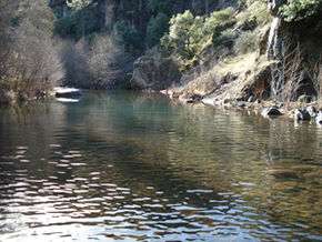
Battle Creek is a 16.6-mile-long (26.7 km)[2] creek located in Shasta and Tehama Counties, California. It is a major tributary to the Sacramento River.
The eastern side of the Battle Creek watershed falls within the northernmost part of the Sierra Nevada mountain range, as it transitions into the southern Cascade range. The undisturbed part of the watershed is richly diverse in both plant and animal species.[3] The tributaries of Battle Creek originate from dozens of underground springs.
The creek is part of a $67 million Chinook salmon restoration project, a PG&E Battle Creek Hydroelectric Project. Many adjacent properties hold conservation easements protecting them from development.
In addition to the Chinook salmon, the creek has steelhead, rainbow, and brown trout. Counterintuitively, first-year data from a post-wildfire soil erosion study funded by Sierra Pacific Industries, a large industrial timber company, show that control sites disturbed only by fire produced substantially more water runoff and soil erosion than did sites that received post-wildfire salvage logging.[4] However, given this document was written by an employee of the large timber company which has extensively salvage logged the watershed, the results are questionable. Furthermore, two hydrologists' reviews of the document found substantial flaws in it.[5][6]

The industrial timberland in the Battle Creek watershed is upstream of the restoration project. The clearcutting and post-fire salvage logging which has been occurring since 1998 is the subject of the documentary film "Clearcut Nation", produced by local residents. A Citizen’s Water Monitoring Project has been collecting water quality data both upstream and downstream of the industrial timberland since 2009. This data was analyzed by a statistical hydrologist in 2014.[7]

References
- ↑ Including the South Fork
- ↑ U.S. Geological Survey. National Hydrography Dataset high-resolution flowline data. The National Map Archived 2012-04-05 at WebCite, accessed March 10, 2011
- ↑ Cal Photos http://calphotos.berkeley.edu/cgi/img_query?where-photographer=Marily+Woodhouse&orderby=taxon
- ↑ James, Cajun "Post Wildfire Salvage Logging, Soil Erosion, and Sediment Delivery, Ponderosa Fire, Battle Creek Watershed, Northern California"
- ↑ Myers, Tom "Review of Study: Inspection of Sierra Pacific Industries’ Ponderosa Post-Fire Sediment Study, Shasta County, California"
- ↑ Lewis, Jack Topographic Characterization of Swales in Sierra Pacific Industries’ Ponderosa Post-Fire Sediment Study, Shasta County, California
- ↑ Lewis, Jack "An Analysis of Turbidity in Relation to Timber Harvesting in the Battle Creek Watershed, northern California September 2014"
External links
- http://www.usbr.gov/mp/battlecreek/public.html
- http://www.battle-creek.net/restoration.html
- http://www.dfg.ca.gov/news/news07/07027.html[]
- https://web.archive.org/web/20150408082925/http://www.spi-ind.com:80/forests_research.aspx
- http://www.thebattlecreekalliance.org/