Beit Lahia, Lebanon
For the city in the Gaza strip, see Beit Lahia.
| Beit Lahia بيت لهيا | |
|---|---|
| Village | |
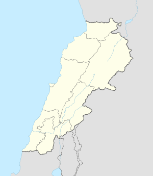 Beit Lahia Location in Lebanon | |
| Coordinates: 33°29′0″N 35°48′7″E / 33.48333°N 35.80194°ECoordinates: 33°29′0″N 35°48′7″E / 33.48333°N 35.80194°E | |
| Country |
|
| Governorate | Beqaa Governorate |
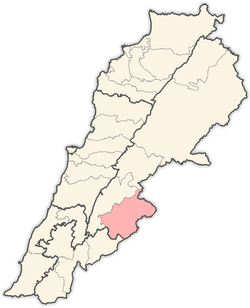
| District | Rashaya District |
Beit Lahia (or Beit Lahya) (Arabic: بيت لهيا) is a village situated in the Rashaya District and south of the Beqaa Governorate in Lebanon.[1] It is located near Mount Hermon and the Syrian border, not far from Rashaya, Aaiha and Kfar Qouq.
The village sits about 955 metres (3,133 ft) above sea level and comprises an area of 392 hectares (3.92 km2).[2]
References
- ↑ Leila Tarazi Fawaz (1994). An occasion for war: civil conflict in Lebanon and Damascus in 1860. University of California Press. pp. 63–. ISBN 978-0-520-20086-9. Retrieved 25 December 2011.
- ↑ Localiban Entry about Beit Lahia (Lebanon)
Capital: Rashaya | ||
| Towns and villages |
|  |
This article is issued from Wikipedia - version of the 11/2/2016. The text is available under the Creative Commons Attribution/Share Alike but additional terms may apply for the media files.