Bhera
| Bhera | |
|---|---|
| Country | Pakistan |
| Province | Punjab |
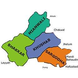
| District | Sargodha |
| Time zone | PST (UTC+5) |
Bhera (Punjabi,Urdu: بهيره), is a city and Tehsil of Sargodha District, Punjab province of Pakistan.
History
According to the "Ancient Geography of India" by Alexander Cunningham, Bhera was once known as Jobnathnagar.[1]
The Imperial Gazetteer of India records the history of Bhera -
| “ | In the seventh and eighth centuries, the Salt Range chieftain was a tributary of Kashmīr. Bhera was sacked by Mahmūd of Ghazni, and again two centuries later by the generals of Chingiz Khān. In 1519 Bābar held it to ransom; and in 1540 Sher Shāh founded a new town, which under Akbar became the headquarters of one of the subdivisions of the Sūbah of Lahore. In the reign of Muhammad Shāh, Rājā Salāmat Rai, a Rājput of the Anand tribe, administered Bhera and the surrounding country; while Khushāb was managed by Nawāb Ahmadyār Khān, and the south-eastern tract along the Chenāb formed part of the territories under the charge of Mahārājā Kaura Mal, governor of Multān[2] | ” |
| “ | About the same time, by the death of Nawāb Ahmdyār Khan, Khushāb also passed into the hands of Rājā Salāmat Rai. Shortly afterwards Abbās Khān a Khattak who held Pind Dādan Khān, treacherously put the Rājā to death, and seized Bhera. But Abbās Khān was himself thrown into prison as a revenue defaulter, and Fateh Singh, nephew of Salāmat Rai then recovered his uncle's dominions.[2] | ” |
In the recent past centuries, Bhera was an important trading outpost on the road to Kabul, and boasted of a taksal (mint) during the rule of Ranjit Singh. The city was known for its knife and cutlery craftsmen, who made fighting daggers (Pesh-kabz) as well as hunting knives and table cutlery, often fitted with handles of serpentine (false jade) or horn.[3] Sir Robert Baden-Powell described the process by which craftsmen manufactured gem-quality serpentine aka false jade from ores obtained from Afghanistan: "The sang-i-yesham (ore) is cut by means of an iron saw, and water mixed with red sand and pounded (with) kurand (corundum). It is polished by application to the san (polishing wheel), wetted with water only, then by being kept wet with water, and rubbed with a piece of wati (smooth pottery fragment), and lastly by rubbing very finely pounded burnt sang-i-yesham on it. This last process must be done very thoroughly."[3]
Attacks on Bhera through history
Bhera has also been attacked by a series of invaders including
- Alexander the Great
- Mahmud of Ghazni – sacked the city[4] in 1004 CE
- Genghis Khan[4]
- Babar holds it to ransom in 1519[4]
- Mirza Muhammad Hakim – sacked the city in 1566 C.E.
- Ahmad Shah Durrani attacks in 1757[4]
Bhera in Ferishta's Chronicle
Farishta records[5] that after attacking Ajoodhun now Pakpattan.
| “ | The King marched from thence to another town in the neighbourhood called Dera the inhabitants of which were originally Khukhrain and were banished thither with their families by Afrasiab, for frequent rebellions. Here they had formed themselves into a small independent state and being cut off from intercourse with their neighbours by a belt of mountains nearly impassable, had preserved their ancient custom and rites, by not intermarrying with any other people. The King, having with infinite labour cleared a road for his army over the mountains advanced towards Dera which was well fortified. This place was remarkable for a fine lake of water about one parsang and a half in circumference. | ” |
Notable people
- Hakeem Noor-ud-Din first caliph of Ahmadiyya and was a renowned physician, and scholar of Arabic and Hebrew.
- Muhammad Karam Shah al-Azhari ex-Justice Supreme Court of Pakistan and Islamic Scholar
- Ehsan-ul-Haq Piracha was Finance Minister of Pakistan from December 4, 1988 to December 6, 1990
- J.C. Anand film producer and distributor, founded Eveready Pictures
- Maulvi Sher Ali was an Ahmadi missionary, known for his English translations of the Quran
- Bashir A. Tahir Sitara-e-Imtiaz
- Javaid Iqbal ex-Chief Justice of Balochistan High court Pakistan
- Neelo Pakistani film actress
- Malik Anwer Ali Noon politician
- Khakan Sajid ahort story writer
Historical places in the vicinity
References
- ↑ Ancient Geography of India, Page 130 – Alexander Cunningham
- 1 2 Imperial Gazetteer of India v22 page 214
- 1 2 Watt, Sir George, The Commercial Products of India, London: John Murray Publishers (1908), p. 561
- 1 2 3 4 Imperial Gazetteer of India v2 page 213
- ↑ Farishta Vo1 Page 80 Translation by John Briggs
External links
Coordinates: 32°29′N 72°55′E / 32.48°N 72.92°E