Bickley railway station
| Bickley | |
|---|---|
 | |
 Bickley Location of Bickley in Greater London | |
| Location | Bickley |
| Local authority | London Borough of Bromley |
| Managed by | Southeastern |
| Station code | BKL |
| DfT category | D |
| Number of platforms | 4 |
| Fare zone | 5 |
| National Rail annual entry and exit | |
| 2010–11 |
|
| – interchange |
|
| 2011–12 |
|
| – interchange |
|
| 2012–13 |
|
| – interchange |
|
| 2013–14 |
|
| – interchange |
|
| 2014–15 |
|
| – interchange |
|
| Key dates | |
| 5 July 1858 | Opened (terminus) |
| 3 December 1860 | Through |
| Other information | |
| Lists of stations | |
| External links | |
| WGS84 | 51°23′58″N 0°02′39″E / 51.3995°N 0.0441°ECoordinates: 51°23′58″N 0°02′39″E / 51.3995°N 0.0441°E |
|
| |
Bickley railway station is the main station serving the affluent area of Bickley which is in the London Borough of Bromley in south London. It lies between Bromley South and Swanley stations. The station is managed by Southeastern, and served by Southeastern and Thameslink, and is in Travelcard Zone 5.
History
The station was opened as Southborough Road by the London, Chatham and Dover Railway (LCDR), on the Chatham Main Line, firstly from the west (London bound) from Bromley on 5 July 1858;[2][3] and then, on 3 December 1860, the line from the east, completing the link between Victoria and Faversham, and later, in 1861, to Dover and Ramsgate. In 1860 the station was renamed Bickley.To the east of the station are what are known as the Bickley Loops which connect the "Chatham Main Line" with the South Eastern Main Line (of the ex South Eastern Railway, constructed in 1902 by the newly unified South Eastern and Chatham Railway.
Layout
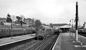
The station lies on the four-track main line, Fast and Slow lines paired; crossovers allow trains to use the Bickley Loops. There are two island platforms, with stairs leading up to the station buildings at the country end of the station, located on Southborough Road.
Services
The typical off-peak service is:
- 4tph to London Victoria via Herne Hill
- 2tph to West Hampstead Thameslink via Catford
- 4tph to Orpington
- 2tph to Sevenoaks via Swanley.
| Preceding station | |
Following station | ||
|---|---|---|---|---|
| Bromley South | Southeastern Bromley South Line |
Petts Wood | ||
| Thameslink Sevenoaks Line |
St Mary Cray or Petts Wood | |||
References
External links
| Wikimedia Commons has media related to Bickley railway station. |
- Train times and station information for Bickley railway station from National Rail
| Companies and organisations | |||||||||||
|---|---|---|---|---|---|---|---|---|---|---|---|
| Airports |
| ||||||||||
| Major stations | |||||||||||
| Roads |
| ||||||||||
| Ticketing | |||||||||||
| Other | |||||||||||
| Former BR sectors | |||||||||||
| |||||||||||