Bitterne Park
| Bitterne Park | |
 Cobden Bridge crosses the River Itchen at Bitterne Park |
|
 Bitterne Park |
|
| Population | 14,026 [1] |
|---|---|
| Unitary authority | Southampton |
| Ceremonial county | Hampshire |
| Region | South East |
| Country | England |
| Sovereign state | United Kingdom |
| Post town | SOUTHAMPTON |
| Postcode district | SO18 |
| Dialling code | 023 |
| Police | Hampshire |
| Fire | Hampshire |
| Ambulance | South Central |
| EU Parliament | South East England |
| UK Parliament | Southampton Itchen |
Coordinates: 50°55′26″N 1°22′18″W / 50.9238°N 1.3718°W
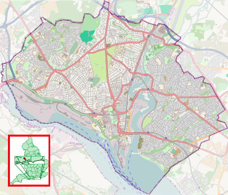
Bitterne Park is a suburb and Electoral Ward of Southampton, England, on the Eastern bank of the River Itchen, built on sloping parkland which once formed part of Bitterne Manor.
Bitterne Park Ward includes the suburbs of Bitterne Park, Bitterne Manor, Midanbury and Townhill Park, and had a population of 14,026 at the 2011 Census.[1] The ward is bounded by Bevois, Portswood and Swaythling wards across the River Itchen to the west, and Harefield and Peartree wards to the east.
History
The National Liberal Land Company purchased the land that is now Bitterne Park in 1882, and began developing it for residential purposes.[2] An iron bridge was constructed across the Itchen to St Denys, thus improving access and vastly increasing the value of the land.
Local area
.jpg)
.jpg)
The area is largely residential, with Bitterne Park Triangle as its focal point. A number of shops cluster around the Triangle.
There have been no banking facilities since the closure of NatWest's Triangle branch in the 1990s and later the Post Office branch, in 2005; however, there are three cash machines. There has been a recent boom in take-away restaurants in Bitterne Park Triangle, including a fish and chip shop, a kebab house, Chinese restaurants, an American pizza house, Thai restaurants and an Indian restaurant. There are various other facilities available such as a laundrette, convenience stores and a bakery.
Bitterne Park is also home to several schools, a local library, and a Buddhist Centre. Since 2008 the Church of the Ascension has contained the lightest ring of twelve bells in the world.[3][4]
Bitterne Park is at the Eastern edge of the Cobden Bridge, which links the area to St. Denys on the Western bank of the River Itchen. The Southern section of Southampton's Riverside Park is located in Bitterne Park. Riverside Park is host to a 1/5 mile miniature railway, children's play areas and several football pitches.
References
- 1 2 "Bitterne Park (Ward) — Key Figures for 2011 Census: Key Statistics". Office for National Statistics. 2011. Retrieved 2015-07-11.
- ↑ http://www.bitternepark.info/index.php?option=com_content&task=view&id=82&Itemid=70 A history of Bitterne Park
- ↑ Dove's Guide: Home page
- ↑ New Bells To Ring Out At City Church (from Daily Echo)
External links
Areas and suburbs of Southampton | |||||||||
|---|---|---|---|---|---|---|---|---|---|
| |||||||||
| Southampton Itchen |
| ||||||||
| Southampton Test | |||||||||
| Romsey and Southampton North | |||||||||
| |||||||||