Bobbing, Kent
| Bobbing | |
 St Bartholomew, Bobbing, Kent |
|
 Bobbing |
|
| Population | 1,969 (2011 Census)[1] |
|---|---|
| OS grid reference | TQ8865 |
| District | Swale |
| Shire county | Kent |
| Region | South East |
| Country | England |
| Sovereign state | United Kingdom |
| Post town | Sittingbourne |
| Postcode district | ME9 |
| Dialling code | 01795 |
| Police | Kent |
| Fire | Kent |
| Ambulance | South East Coast |
| EU Parliament | South East England |
Coordinates: 51°21′00″N 0°42′00″E / 51.349998°N 0.700000°E
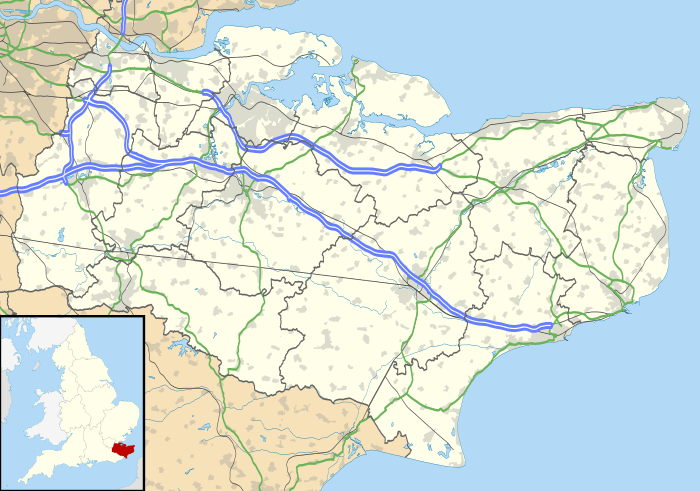
Bobbing is a village and civil parish in the Swale district of Kent, England, about a mile north-west of Sittingbourne, and forming part of its urban area. The hamlet of Howt Green and village of Keycol are encompassed within the parish. According to the 2011 census Bobbing parish had a population of 1,969.[1]
The parish of Bobbing, according to Edward Hasted in 1800, contains about seven hundred and eighty acres of land, of which forty were wood.[2]
The mediaeval manor house of Bobbing Court, now a Grade II listed ruin, was built by the Savage family; it passed to the distinguished soldier Sir Conyers Clifford, and then by marriage into the St. Leger family.[3]
The village church, St Bartholomew, is a grade I listed building.[4] Which is in the diocese of Canterbury and deanery of Sittingbourne.[5] According to Edward Hasted in 1798, the church consisted of two small isles and two chancels, having a tall spire steeple at the west end of it, in which are five bells.[6]
The strange career of Titus Oates, inventor of the Popish Plot, included a brief period as Vicar of Bobbing.[7] He was presented with the living by the local squire, Sir George Moore ( who had recently purchased Bobbing Court) in 1673, but his drunkenness and blasphemy so horrified his parishioners that they ejected him before the end of the year.[8]
In 2003 the Cremation Society of Great Britain opened the "Garden of England Crematorium" on the outskirts of the village.[9]
References
- 1 2 "Neighbourhood Statistics Bobbing (Parish)". Office for National Statistics. Gov UK. March 2011. Retrieved 19 September 2015.
- ↑ Hasted, Edward (1800). "Parishes". The History and Topographical Survey of the County of Kent. Institute of Historical Research. 6: 192–203. Retrieved 12 February 2014.
- ↑ Mosley ed. Burke's Peerage 107th Edition Vol.1 p.1160
- ↑ "Church of St Bartholomew, Bobbing". British Listed Buildings. Retrieved 14 September 2015.
- ↑ "St Bartholomew, Bobbing". A Church Near You. Archbishops' Council. 25 August 2015. Retrieved 14 September 2015.
- ↑ Hasted, Edward (1798). "Parishes Bobbing". The History and Topographical Survey of the County of Kent. Institute of Historical Research. 6: 192–203. Retrieved 14 September 2015.
- ↑ Kenyon, J.P. The Popish Plot Phoenix Press reissue 2000 p.54
- ↑ Kenyon p.54
- ↑ "Garden of England Crematorium". London Cremation Company. The London Cremation Company plc. 2014. Retrieved 14 September 2015.
External links
![]() Media related to Bobbing, Kent at Wikimedia Commons
Media related to Bobbing, Kent at Wikimedia Commons