Bonsecours, Quebec
| Bonsecours | |
|---|---|
| Municipality | |
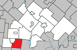 Location within Le Val-Saint-François RCM. | |
 Bonsecours Location in southern Quebec. | |
| Coordinates: 45°25′N 72°17′W / 45.417°N 72.283°WCoordinates: 45°25′N 72°17′W / 45.417°N 72.283°W[1] | |
| Country |
|
| Province |
|
| Region | Estrie |
| RCM | Le Val-Saint-François |
| Constituted | March 20, 1905 |
| Government[2] | |
| • Mayor | Cécile Laliberté |
| • Federal riding | Shefford |
| • Prov. riding | Orford |
| Area[2][3] | |
| • Total | 61.20 km2 (23.63 sq mi) |
| • Land | 60.47 km2 (23.35 sq mi) |
| Population (2011)[3] | |
| • Total | 577 |
| • Density | 9.5/km2 (25/sq mi) |
| • Pop 2006-2011 |
|
| • Dwellings | 303 |
| Time zone | EST (UTC−5) |
| • Summer (DST) | EDT (UTC−4) |
| Postal code(s) | J0E 1H0 |
| Area code(s) | 450 and 579 |
| Highways |
|
| Website |
www |
Bonsecours is a municipality in Le Val-Saint-François Regional County Municipality in the Estrie region of Quebec.
Demographics
Population
| Historical Census Data - Bonsecours, Quebec[4] | ||||||||||||||||||||||||||
|---|---|---|---|---|---|---|---|---|---|---|---|---|---|---|---|---|---|---|---|---|---|---|---|---|---|---|
|
|
| ||||||||||||||||||||||||
Language
Mother tongue (2011)[3]
| Language | Population | Pct (%) |
|---|---|---|
| French only | 555 | 95.7% |
| English only | 20 | 3.4% |
| Non-official languages | 5 | 0.9% |
See also
References
- ↑ Reference number 6983 of the Commission de toponymie du Québec (French)
- 1 2 Geographic code 42040 in the official Répertoire des municipalités (French)
- 1 2 3 "(Code 2442040) Census Profile". 2011 census. Statistics Canada. 2012.
- ↑ Statistics Canada: 1996, 2001, 2006, 2011 census
 |
Lawrenceville | Valcourt (township) | Racine | |
| Sainte-Anne-de-la-Rochelle | |
Orford | ||
| ||||
| | ||||
| Stukely-Sud | Eastman |
| Cities & Towns | |
|---|---|
| Municipalities | |
| Townships | |
| Villages | |
| |
This article is issued from Wikipedia - version of the 3/2/2014. The text is available under the Creative Commons Attribution/Share Alike but additional terms may apply for the media files.