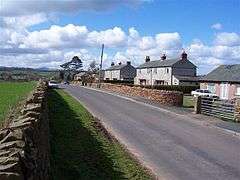
Brockleymoor
Coordinates: 54°43′26″N 2°47′46″W / 54.724°N 2.796°W
Brockleymoor was a hamlet in Cumbria, England but it is now part of the village of Plumpton. It is located several miles north of Penrith, not far from the M6 motorway.[1]
See also
References
| Wikimedia Commons has media related to Brockleymoor. |
- ↑ Maps (Map). Google Maps.
This article is issued from Wikipedia - version of the 2/7/2016. The text is available under the Creative Commons Attribution/Share Alike but additional terms may apply for the media files.

