Broulee Island Nature Reserve
| Broulee Island Nature Reserve New South Wales | |
|---|---|
|
IUCN category Ia (strict nature reserve) | |
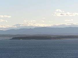 Broulee Island looking south from Burri Point | |
 Broulee Island Nature Reserve | |
| Nearest town or city | Broulee |
| Coordinates | 35°51′28″S 150°11′18″E / 35.85778°S 150.18833°ECoordinates: 35°51′28″S 150°11′18″E / 35.85778°S 150.18833°E |
| Established | April 1972[1] |
| Area | 0.43 km2 (0.2 sq mi)[1] |
| Managing authorities | NSW National Parks & Wildlife Service |
| Website | Broulee Island Nature Reserve |
| See also |
Protected areas of New South Wales |
The Broulee Island Nature Reserve is a protected nature reserve located on the south coast of New South Wales, Australia. The 43 ha (110 acres) reserve was created in 1972 and is managed by the NSW National Parks & Wildlife Service. The reserve is situated 23 kilometres (14 mi) south of Batemans Bay and is adjacent to the village of Broulee.
As of July 2008 a tombolo connected Broulee Island to the mainland at Broulee Head. Broulee Island Nature Reserve is located entirely in Eurobodalla Shire and within the boundaries of the Mogo Local Aboriginal Land Council.[2]
Gallery

Panorama from the sand spit, looking north-east; Burrewarra Point to the left.
-
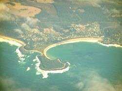
Broulee aerial photo from east
-
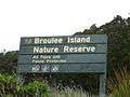
A directional sign at Broulee Island
See also
References
- 1 2 "Broulee Island Nature Reserve". Office of Environment and Heritage. Government of New South Wales. Retrieved 16 September 2014.
- ↑ "Broulee Island Nature Reserve: Plan of Management" (PDF). NSW National Parks & Wildlife Service (PDF). Government of New South Wales. 21 July 2008. ISBN 1-74122-313-X. Retrieved 16 September 2014.
External links
- "Broulee Island Nature Reserve: Plan of Management" (PDF). NSW National Parks & Wildlife Service (PDF). Government of New South Wales. 21 July 2008. ISBN 1-74122-313-X.
This article is issued from Wikipedia - version of the 5/7/2016. The text is available under the Creative Commons Attribution/Share Alike but additional terms may apply for the media files.