Gumbaynggirr State Conservation Area
| Gumbayngirr State Conservation Area New South Wales | |
|---|---|
 | |
 Gumbayngirr State Conservation Area | |
| Nearest town or city | Nambucca Heads |
| Coordinates | 30°35.4578′S 152°35.4198′E / 30.5909633°S 152.5903300°ECoordinates: 30°35.4578′S 152°35.4198′E / 30.5909633°S 152.5903300°E |
| Established | 1 July 2003[1] |
| Area | 25.61 km2 (9.9 sq mi)[1] |
| Managing authorities | NSW National Parks and Wildlife Service |
| Website | Gumbayngirr State Conservation Area |
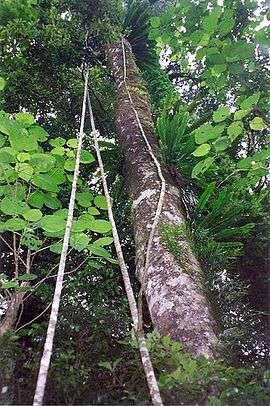
The Gumbayngirr State Conservation Area is a protected conservation area located in the Mid North Coast region of New South Wales, in eastern Australia. The 2,561-hectare (6,330-acre) conservation area is situated west of Nambucca Heads and contains a sub–tropical jungle, known as the League Scrub.
Features
Part of the reserve is situated on a basaltic bench, with relatively fertile red soils. Pumice can be seen on the forest floor, indicating previous volcanic activity. The altitude is 750 metres (2,460 ft) above sea level with a high rainfall. The rainforest has not been logged, and consists of a diverse jungle of 73 tree species, forming an impressive 40 metres (130 ft) canopy.
Significant tree species include Stinging Tree, Yellow Carabeen, Moreton Bay Fig, Small leaf fig, Black Booyong, Bonewood, Purple Cherry, Sour Cherry and Rose Maple.[2]
Gallery
-
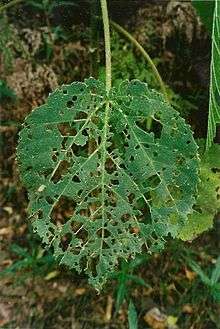
leaf of the Giant Stinging Tree, Gumbaynggirr State Conservation Area
-

Sour Cherry, fruit on the rainforest floor, Gumbaynggirr State Conservation Area
-
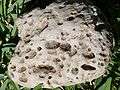
Pumice from the rainforest floor at Gumbaynggirr State Conservation Area
See also
References
- 1 2 "Gumbayngirr State Conservation Area: Park management". Office of Environment and Heritage. Government of New South Wales. Retrieved 21 September 2014.
- ↑ Floyd, A. G. Australian Rainforests of New South Wales. 2. p. 28. ISBN 0-949324-32-9.
External links
- "Gumbaynggirr National Park and Gumbayngirr State Conservation Area: Statement of Management Intent" (PDF). Office of Environment and Heritage (PDF). Government of New South Wales. May 2014. ISBN 978-1-74359-481-0.
- "League Scrub". Picassa.