Burbank Hills
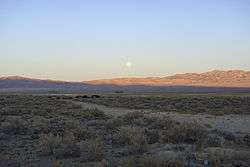
The Burbank Hills is a small northwest-southeast mountain range in western Utah that lies entirely within Hamlin-Snake Watershed between the Snake Range and, to the northeast and east, the Ferguson Desert.[1] It is bounded by Snake Valley to the north, west, and south; and trends into the Tunnel Springs Mountains, to the southeast, opposite the Antelope Valley on its southeast border. It was named after the settlement of Burbank, Utah and Margie Burbank Clay, the wife of local Judge E. W. Clay in the 1870s.
The Burbank Hills has numerous ATV trails[2] and fossils.[3]
Geology
The structural trend of rocks in the range are similar to rocks in the northern Mountain Home Range to the southwest and Conger Range and central Confusion Range to the northeast. These are chiefly Devonian to Permian carbonate rocks arranged in a massive 30-by-50-mile (48 by 80 km) syncline.[4][5]
References
- ↑ Water Resources (PDF) (Report). Reconnaissance Series. Carson City: NV Department of Conservation and Natural Resources. Retrieved 2010-10-21.
- ↑ http://www.utah.com/offroad/west_desert.htm
- ↑ http://palaios.sepmonline.org/cgi/content/abstract/12/4/397
- ↑ Halka Chronic, 1990, Roadside Geology of Utah, ISBN 0-87842-228-5
- ↑ Hintze and Davis, 2002, GEOLOGIC MAP OF THE WAH WAH MOUNTAINS NORTH 30′ x 60′ QUADRANGLE AND PART OF THE GARRISON 30′ x 60′ QUADRANGLE, SOUTHWEST MILLARD COUNTY AND PART OF BEAVER COUNTY, UTAH, ISBN 1-55791-584-9
External links
- "Burbank Hills". Geographic Names Information System. United States Geological Survey. Retrieved 2012-12-18.
Coordinates: 38°49′55″N 113°48′36″W / 38.83194°N 113.81000°W