Burgh Heath
| Burgh Heath | |
 St Mary's parish church |
|
 Burgh Heath |
|
| Population | 1,884 (2011 Census) |
|---|---|
| OS grid reference | TQ242580 |
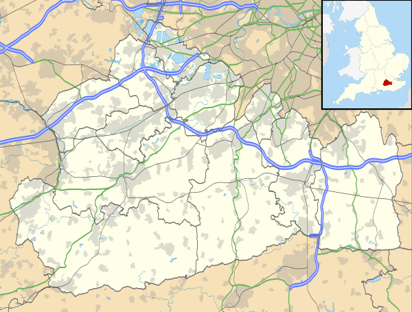
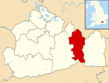
| District | Reigate and Banstead |
| Shire county | Surrey |
| Region | South East |
| Country | England |
| Sovereign state | United Kingdom |
| Post town | Tadworth |
| Postcode district | KT20 |
| Dialling code | 01737 |
| Police | Surrey |
| Fire | Surrey |
| Ambulance | South East Coast |
| EU Parliament | South East England |
| UK Parliament | Reigate |
Coordinates: 51°18′18″N 0°13′12″W / 51.305°N 0.220°W
Burgh Heath (/ˌbɜːr ˈhiːθ/ or, especially amongst older residents, /ˌbʌrə ˈhiːθ/)[1] is a residential neighbourhood with a remnant part of the Banstead Commons of the same name. Immediately north of Upper Kingswood on the A217 road, it adjoins part of Banstead to the north. The north of the area is more specifically called Great Burgh, but the terms are largely interchangeable.
History
Burgh or Great Burgh was a very old manor of Banstead with an Old English name which was one of several settlements to have seen very little expansion before the end of the 19th century being on land which was part of the large, and water-scarce Banstead Heath or Common on the North Downs. It developed into a village-like hamlet in the early part of the 20th century.[2]
The Domesday Book records a church at Burgh, connected with its manor held by Odo, Earl of Kent.[3] Rectors were instituted to it in the 14th and 15th centuries, but there is no evidence of its having been a separate parish from Banstead after 1414, in the latter's many governmental and ecclesiastical patent, enquiry and taxation rolls.[2] Bergh or Burgh Church was between Little Burgh House and Church Lane, where the foundations remained supporting a barn until about 1880.[2]
The present Church of England parish church of Saint Mary is a Gothic revival building completed in 1909.[4]
Geography
Burgh Heath is a residential settlement centred on a remnant part of the Banstead Commons of the same name on upper slopes of the North Downs. Adjoining are Nork an neighbourhood of the village Banstead which has that village's train station, directly north and Upper Kingswood to the south. The dual carriageway has meant that today there are two separate areas of housing: a larger part with shops on the main road and surrounding Canons Lane to the east and the other to the west close to the ponds, facing Burgh Heath and to distinguish it from the built up sections, known to its residents as "The Green". The 2011 Census recorded Burgh Heath's population as 1,884 people living in 843 households.[5]
Burgh Heath has a large supermarket store, a luxury sports car garage and Toyota's UK headquarters are in the north of the area at Great Burgh. There is a parade of shops along the A217 of small independent retailers and several small restaurants. However, the majority of residents in the area are commuters out of the area.
Open areas of Burgh Heath
The residential area is bordered to the south by the Burgh Heath itself, one of four parts of Banstead Commons, managed by the Banstead Commons Conservators and its byelaws. It is bordered east and north by farmland leading to Banstead Woods, managed by local authority Reigate and Banstead borough council.[2]
Beside the supermarket is a triangular wood in part of which is Burgh Heath BMX Track.[6]
References
- ↑ Davison, Mark (26 October 2014). "A look back to yesteryear: when a Surrey village was a holiday resort". Surrey Mirror. Local World. Retrieved 13 March 2015.
- 1 2 3 4 Malden 1911, pp. 252–262
- ↑ "Burgh". Open Domesday.
- ↑ Nairn 1971, p. 121.
- ↑ "Area: Reigate and Banstead 007D (Lower Layer Super Output Area): Key Figures for 2011 Census: Key Statistics". Neighbourhood Statistics. Office for National Statistics. Retrieved 22 August 2016.
- ↑ "Directory of local parks and countryside in the Borough, including details about facilities at each". Reigate and Banstead Borough Council. Archived from the original on 2013-11-01.
Sources
- Malden, HE, ed. (1911). "Banstead". A History of the County of Surrey. Victoria County History. III. Westminster: Constable & Co Ltd. pp. 252–262.
- Nairn, Ian; Pevsner, Nikolaus; Cherry, Bridget (revision) (1971) [1962]. Surrey. The Buildings of England (2nd ed.). Harmondsworth: Penguin Books. p. 121. ISBN 0-14-071021-3.
External links
![]() Media related to Burgh Heath at Wikimedia Commons
Media related to Burgh Heath at Wikimedia Commons
| Towns, villages, neighbourhoods and hamlets |
|  | ||||||||||||||||||||||||||
|---|---|---|---|---|---|---|---|---|---|---|---|---|---|---|---|---|---|---|---|---|---|---|---|---|---|---|---|---|
| Most notable parks | ||||||||||||||||||||||||||||
| Places of worship | ||||||||||||||||||||||||||||
| Education | ||||||||||||||||||||||||||||
| Transport |
| |||||||||||||||||||||||||||
| Buildings and structures | ||||||||||||||||||||||||||||
| Sport | ||||||||||||||||||||||||||||
| Politics and Administration | ||||||||||||||||||||||||||||
Places listed are articles notable as settlements, arranged by post town The two principal towns are emboldened The M23 motorway follows approximately a boundary and is chiefly included for its regional importance. | ||||||||||||||||||||||||||||