Cadder

Coordinates: 55°55′N 4°13′W / 55.92°N 04.22°W
Cadder (Scottish Gaelic: Coile Dobhair) is a district of the town of Bishopbriggs, East Dunbartonshire, Scotland. It is located 7 km north of Glasgow city centre, 0.5 km south of the River Kelvin, and approximately 1.5 km north-east of Bishopbriggs town centre, sited on the route of the Forth and Clyde Canal. There is a Glasgow council housing scheme of a similar name, generally pronounced Cawder, in the district of Lambhill some 4 km to the west along the Canal, which was built in the early 1950s. Similarly, within Cadder, there is also Cawder Golf Club, which also uses that alternative spelling.
In antiquity, Cadder was the site of a Roman fort on the route of the Antonine Wall.[1] Cadder House was a property held by the Stirling family for generations.[2]
Cadder has a large cemetery, is also the site of Strathkelvin Retail Park and Low Moss (HM Prison).[3]
Gallery
-
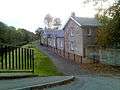
Cadder stables
-
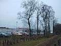
Strathkelvin retail park