Calarcá
| Calarcá, Quindío | |||
|---|---|---|---|
| Municipality and town | |||
| |||
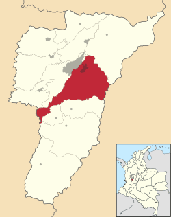 Location of the municipality and town of Calarcá, Quindío in the Quindío Department of Colombia. | |||
 Calarcá, Quindío Location in Colombia | |||
| Coordinates: 4°31′55″N 75°39′01″W / 4.53194°N 75.65028°W | |||
| Country |
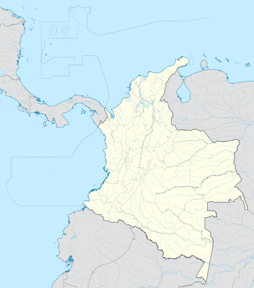
| ||
| Department | Quindío Department | ||
| Founded | 1886 | ||
| Government | |||
| • Mayor | Juan Carlos Giraldo Romero | ||
| Area | |||
| • Total | 219.23 km2 (84.65 sq mi) | ||
| Elevation | 1,573 m (5,161 ft) | ||
| Population (2012) | |||
| • Total | 59,817 | ||
| • Density | 270/km2 (710/sq mi) | ||
| Demonym(s) | Calarqueño | ||
| Time zone | Colombia Standard Time (UTC-5) | ||
| Area code(s) | 57 + 6 | ||
| Website | Official website (Spanish) | ||
.svg.png)
.svg.png)
Calarcá is a municipality in the eastern part of the department of Quindío, Colombia. It is located 4 km east of the departmental capital Armenia. Its nickname is La Villa del Cacique.
In 2005 it had an estimated population of 82,400, of which 62,100 live in the main urban zone.
History
The name derived from an indigenous chief of the Pijaos Tribe, who lived in this land. According to the legends, this chief died in a fight with an indigenous converted into the Catholicism, Baltazar Maldonado, to keep the power of the territory, in a fight placed on Peñas Blancas, a characteristic mountain of the city.
Calarcá was founded on June 29 of 1886. The city was founded by Roman Mario Valencia and Segundo Henao, people who went from Salento making explorations through the region, in the final part of the antioqueña foundations. In the beginning the city based its economy on mining and commerce. Years later about 30's the coffee arrived in the region and Calarcá became in one of the most important producers of the region and whole the country. The wealthy generated by the coffee, allowed the city to reach good conditions of developed and a cultural progress, which started to characterize the city as a cradle of poets, such as Luis Vidales and Bauidilio Montoya.
The city is host of different events, such as the national festival of the coffee, among the many activities there is one called "yippao" where different Jeep's (a characteristic car of the region) are customized by their owner and go through the city, the national meeting of writers.
In 1999 the city was partially destroyed for an eventually earthquake, which affected the department. This made the city lose part of the architectural heritage.
Geography
The municipality of Calarcá is located between 4° 20’ 40” and 4° 33’ 50” north and between 75° 33’ 40” and 75° 48’ 40” west. The inner city is located 4° 33’ 0.6” north and 75° 39’ 00” west. It lies in the Andean zone flanking the Central Cordillera, east of the department of Quindío in the centre-western part of the country, within the area known as the Eje Cafetero ("Coffee Axis"). Calarcá is bordered by the municipalities of Salento to the north, Cajamarca (Tolima) to the east, Córdoba, Buenavista, Pijao in Quindío and Caicedonia in the Cauca Valley to the south, and La Tebaida y Armenia to the west.
The municipality has an area of 219.23 km². Urban area is 2.44 km². Rural area is 216.79 km². It varies in altitude between 1000 m above sea level at the confluence of the Quindío y Barragán rivers to 3667 m above sea level in the El Campanario highland area. The city itself sits at an average of 1536 m above sea level.
Economy
Just like in others towns in the Quindio, the economy is based in colombian coffee crops, plantain and manioc. The ecotourism is promoted with destinations such as
- Peñas Blancas park, with rock climbing and hiking activities
- El Mariposario, enthomologic display specialized in Lepidoptera
- Quindio botanical garden
Other important source of income is money remittance from people working in other countries to their families.
Notable inhabitants
- Luis Vidales (1904–1990) Poet and writer
- Baudilio Montoya Poet
- Francisco Noe Torres Rincon Artist
- Octavio Guzmán Bahen Physicist
- Noel Estrada Roldan Poet
- Fabio Botero Cartoonist
- Hernando Jiménez Sánchez Artist
- Olga Lucia Roldan Artist
- Gloria Cecilia Díaz Writer
- Jaime Lopera Gutierrez Writer
- Lucelly García de Montoya Politician
- Jairo Ramon Pelaez Cartoonist
- Jairo Alvarez Osorio Cartoonist
- Jairo Ramon Pelaez Cartoonist
- Carlos A. Villegas U.o Writer
External links
- Alcaldía Municipal de Calarcá. Official web page of the city council (in Spanish).
References
Lopera Gutiérrez, Jaime, La Colonización del Quindío.
Loaiza Piedrahita, Oscar (2004), Los corredores del tiempo: Guía turística por la historia del Quindío. ISBN 958-33-7088-6. Book in Spanish on the history of the municipalities of Quindío until the foundation of the department in 1966. The local history is placed in the context of wider events in Colombia.
| Population over 50,000 |  | |
|---|---|---|
| Population over 20,000 | ||
| Population under 20,000 | ||
Coordinates: 4°32′N 75°39′W / 4.533°N 75.650°W