Canyon Day, Arizona
| Canyon Day, Arizona | |
|---|---|
| Census-designated place | |
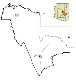 Location in Gila County and the state of Arizona | |
 Canyon Day, Arizona Location in the United States | |
| Coordinates: 33°47′16″N 110°1′25″W / 33.78778°N 110.02361°WCoordinates: 33°47′16″N 110°1′25″W / 33.78778°N 110.02361°W | |
| Country | United States |
| State | Arizona |
| County | Gila |
| Area | |
| • Total | 5.08 sq mi (13.16 km2) |
| • Land | 5.02 sq mi (13.01 km2) |
| • Water | 0.06 sq mi (0.15 km2) |
| Elevation | 5,000 ft (1,524 m) |
| Population (2010) | |
| • Total | 1,209 |
| • Density | 241/sq mi (92.9/km2) |
| Time zone | MST (no DST) (UTC-7) |
| FIPS code | 04-10040 |
| GNIS feature ID | 0002435 |
Canyon Day (Western Apache Yangongai) is a census-designated place (CDP) in Gila County, Arizona, United States. The population was 1,209 at the 2010 census.[1]
Geography
Canyon Day is located in easternmost Gila County at 33°47′16″N 110°1′25″W / 33.78778°N 110.02361°W (33.787774, -110.023655).[2] It is bordered to the east by Fort Apache in Navajo County. Arizona State Route 73 passes through Canyon Day, leading northeast 24 miles (39 km) to Hondah or Indian Pine and northwest 23 miles (37 km) to U.S. Route 60 near Carrizo.
According to the United States Census Bureau, the CDP has a total area of 5.08 square miles (13.16 km2), of which 5.02 square miles (13.01 km2) is land and 0.058 square miles (0.15 km2), or 1.16%, is water.[1] The White River, a west-flowing tributary of the Salt River, forms the southern edge of the Canyon Day CDP.
Demographics
As of the census[3] of 2000, there were 1,092 people, 271 households, and 227 families residing in the CDP. The population density was 285.1 people per square mile (110.1/km²). There were 301 housing units at an average density of 78.6/sq mi (30.3/km²). The racial makeup of the CDP was 1.01% White, 98.53% Native American, 0.18% from other races, and 0.27% from two or more races. 0.64% of the population were Hispanic or Latino of any race.
There were 271 households out of which 51.7% had children under the age of 18 living with them, 46.1% were married couples living together, 31.7% had a female householder with no husband present, and 16.2% were non-families. 15.5% of all households were made up of individuals and 2.2% had someone living alone who was 65 years of age or older. The average household size was 4.03 and the average family size was 4.42.
In the CDP the population was spread out with 43.6% under the age of 18, 9.2% from 18 to 24, 26.1% from 25 to 44, 17.0% from 45 to 64, and 4.0% who were 65 years of age or older. The median age was 23 years. For every 100 females there were 92.9 males. For every 100 females age 18 and over, there were 84.4 males.
The median income for a household in the CDP was $20,987, and the median income for a family was $22,633. Males had a median income of $25,469 versus $17,813 for females. The per capita income for the CDP was $6,940. About 32.2% of families and 40.0% of the population were below the poverty line, including 46.5% of those under age 18 and 8.0% of those age 65 or over.
See also
References
- 1 2 "Geographic Identifiers: 2010 Demographic Profile Data (G001): Canyon Day CDP, Arizona". U.S. Census Bureau, American Factfinder. Retrieved October 28, 2016.
- ↑ "US Gazetteer files: 2010, 2000, and 1990". United States Census Bureau. 2011-02-12. Retrieved 2011-04-23.
- ↑ "American FactFinder". United States Census Bureau. Archived from the original on 2013-09-11. Retrieved 2008-01-31.
Municipalities and communities of Gila County, Arizona, United States | ||
|---|---|---|
| City |  | |
| Towns | ||
| CDPs |
| |
| Unincorporated communities | ||
| Indian reservations | ||
| Ghost towns | ||
| Footnotes | ‡This populated place also has portions in an adjacent county or counties | |