Capão Bonito
| Capão Bonito | |||
|---|---|---|---|
| Municipality | |||
|
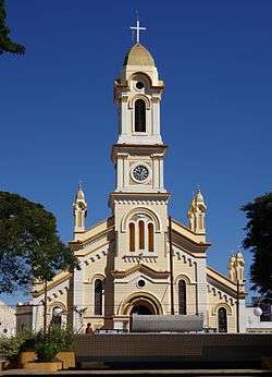
Igreja Matriz | |||
| |||
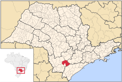 Location in São Paulo state | |||
 Capão Bonito Location in Brazil | |||
| Coordinates: 24°0′21″S 48°20′58″W / 24.00583°S 48.34944°WCoordinates: 24°0′21″S 48°20′58″W / 24.00583°S 48.34944°W | |||
| Country |
| ||
| Region | Southeast Region | ||
| State | São Paulo | ||
| Area[1] | |||
| • Total | 1,640 km2 (630 sq mi) | ||
| Population (2015)[1] | |||
| • Total | 47,486 | ||
| • Density | 29/km2 (75/sq mi) | ||
| Time zone | BRT/BRST (UTC-3/-2) | ||

Capão Bonito is a municipality in the state of São Paulo in Brazil. The population is 47,486 (2015 est.) in an area of 1640 km².[1] The elevation is 705 m.
References
This article is issued from Wikipedia - version of the 11/14/2016. The text is available under the Creative Commons Attribution/Share Alike but additional terms may apply for the media files.