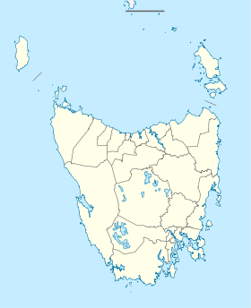
Cape Portland, Tasmania
| Cape Portland Tasmania | |
|---|---|
 Cape Portland | |
| Coordinates | 40°44′58″S 147°56′43″E / 40.74944°S 147.94528°ECoordinates: 40°44′58″S 147°56′43″E / 40.74944°S 147.94528°E |
| Postcode(s) | 7264 |
| LGA(s) | Dorset Council |
Cape Portland (indigenous name: Lumaranatana) is both a geographical feature and a locality near the north-eastern tip of Tasmania, Australia. It points west across Ringarooma Bay. It was named after the Duke of Portland by Matthew Flinders during his 1798 circumnavigation of the island in the sloop Norfolk with George Bass.
History
Cape Portland Post Office opened on 6 April 1865 (first as a receiving house) and finally closed in 1918.[1]
Birds
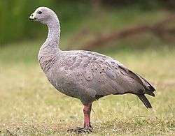
It is the site of the 67 km2 Cape Portland Important Bird Area which includes the cape itself, some adjacent land, a strip of coastline east of the cape extending to Policemans Point at the mouth of Ansons Bay, and nearby Swan Island. This area supports more than 1% of the world population of the Cape Barren goose, chestnut teal and the near threatened hooded plover. It also occasionally supports large numbers of pied oystercatchers, double-banded plovers and breeding fairy terns.[2]
References
- ↑ Premier Postal History. "Post Office List". Premier Postal Auctions. Retrieved 16 June 2012.
- ↑ "IBA: Cape Portland". Birdata. Birds Australia. Archived from the original on 6 July 2011. Retrieved 2011-06-12.