Carlton, Saskatchewan
| Carlton, Saskatchewan | |
|---|---|
| Unincorporated Hamlet | |
 | |
| Coordinates: 52°48′47″N 106°29′20″W / 52.813°N 106.489°WCoordinates: 52°48′47″N 106°29′20″W / 52.813°N 106.489°W | |
| Country | Canada |
| Province | Saskatchewan |
| Region | Southwest Saskatchewan |
| Census division | 8 |
| Rural Municipality | Rosthern |
| Established | 1912 |
| Government | |
| • Governing body | Rosthern No. 403 |
| • Reeve | Bruce Fehr |
| • Administrator | James F. Spriggs |
| Area | |
| • Total | 0.00 km2 (0.00 sq mi) |
| Population (2006) | |
| • Total | 0 |
| • Density | 0.0/km2 (0/sq mi) |
| Time zone | CST |
| Postal code | S0K 3R0 |
| Area code(s) | 306 |
| Highways |
Highway 44 Highway 683 |
| [1][2][3][4] | |
Carlton is a hamlet in Rosthern Rural Municipality No. 403, Saskatchewan, Canada. The hamlet is located on Highway 683, approximately 20 km north-west of Rosthern.
Attractions
Fort Carlton Provincial Historic Park

The original site of Fort Carlton[5] is located approximately 5 km north-west of Carlton along the banks of the North Saskatchewan River. The fort was originally established as a Hudson’s Bay Company fur trading post that operated between 1810 until 1885. The fort has been rebuilt by the Government of Saskatchewan and is now known as a Provincial Park of Saskatchewan and is a popular attraction located along the original Carlton Trail.
Carlton Trail
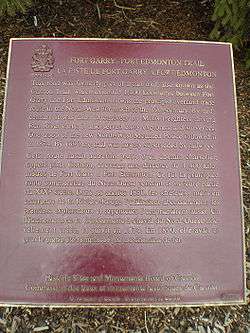
The Carlton Trail was the primary land transportation route connecting the various parts of the Canadian Northwest for most of the 19th century. It stretched from the Red River Colony up to what is today Fort Qu'Appelle, Saskatchewan via Fort Ellice. From here the trail ran north and crossed the South Saskatchewan River near Batoche, Saskatchewan until it reached Fort Carlton on the North Saskatchewan River. After this point the trail ran due west along the river to Fort Edmonton at what is now Edmonton, Alberta. The distance in total the trail traveled between Fort Garry (Winnipeg) to Upper Fort des Prairies (Edmonton) was approximately 900 miles (1,500 kilometers). Many smaller trails jutted off from the main trail, such as the Fort à la Corne Trail in the Saskatchewan Valley. Today the Trail has been designated as a National Historic Site of Canada and portions of the original Trail can still be seen.
See also
References
- ↑ National Archives, Archivia Net, Post Offices and Postmasters, archived from the original on 2006-10-06
- ↑ Government of Saskatchewan, MRD Home, Municipal Directory System, archived from the original on November 21, 2008
- ↑ Canadian Textiles Institute. (2005), CTI Determine your provincial constituency, archived from the original on 2007-09-11
- ↑ Commissioner of Canada Elections, Chief Electoral Officer of Canada (2005), Elections Canada On-line, archived from the original on 2007-04-21
- ↑ Fort Carlton Provincial Historic Park
External links
 |
Marcelin | Wandsworth | Titanic | |
| Blain Lake | |
Duck Lake | ||
| ||||
| | ||||
| Waldheim | Laird | Rosthern |
| Subdivisions | |
|---|---|
| Communities | |
| Cities | |
| Topics |
|
| |