Cathcart, Eastern Cape
| Cathcart | |
|---|---|
|
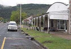
Main street in Cathcart | |
 Cathcart  Cathcart  Cathcart
| |
| Coordinates: 32°18′S 27°08′E / 32.300°S 27.133°ECoordinates: 32°18′S 27°08′E / 32.300°S 27.133°E | |
| Country | South Africa |
| Province | Eastern Cape |
| District | Amathole |
| Municipality | Amahlathi |
| Established | 1858[1] |
| Area[2] | |
| • Total | 30.1 km2 (11.6 sq mi) |
| Population (2011)[2] | |
| • Total | 7,360 |
| • Density | 240/km2 (630/sq mi) |
| Racial makeup (2011)[2] | |
| • Black African | 93.4% |
| • Coloured | 2.0% |
| • Indian/Asian | 0.1% |
| • White | 4.3% |
| • Other | 0.2% |
| First languages (2011)[2] | |
| • IsiXhosa | 90.6% |
| • English | 4.5% |
| • Afrikaans | 3.1% |
| • Other | 1.8% |
| Postal code (street) | 5310 |
| PO box | 5310 |
| Area code | 045 |
Cathcart is a town in the Eastern Cape province of South Africa, named after Sir George Cathcart, governor of the Cape of Good Hope 1852–1853.
The town is situated on the N6, just north of Stutterheim en route to Queenstown

Originally a small military post, established during the Eighth Frontier War, it was established as a village in 1858 when German colonists arrived in the region. Work on its railway connection to East London on the coast was begun by the Cape government of John Molteno in 1876 and the line was officially opened on 3 November 1879.[3]
Notable people
References
- ↑ "Chronological order of town establishment in South Africa based on Floyd (1960:20–26)" (PDF). pp. xlv–lii.
- 1 2 3 4 Sum of the Subplaces Katikati SP, Daliwe SP, Carthcart SP and Rocklands from Census 2011.
- ↑ Burman, Jose (1984), Early Railways at the Cape. Cape Town: Human & Rousseau, p.83. ISBN 0-7981-1760-5
External links
![]() Media related to Cathcart at Wikimedia Commons
Media related to Cathcart at Wikimedia Commons
Municipalities and communities of Amathole District Municipality, Eastern Cape | ||
|---|---|---|
District seat: East London | ||
| Amahlathi | .svg.png) | |
| Great Kei | ||
| Mbhashe | ||
| Mnquma | ||
| Ngqushwa | ||
| Raymond Mhlaba | ||
This article is issued from Wikipedia - version of the 9/20/2016. The text is available under the Creative Commons Attribution/Share Alike but additional terms may apply for the media files.