Centerville, South Carolina
| Centerville, South Carolina | |
|---|---|
| Census-designated place | |
 Location of Centerville, South Carolina | |
| Coordinates: 34°31′21″N 82°42′53″W / 34.52250°N 82.71472°WCoordinates: 34°31′21″N 82°42′53″W / 34.52250°N 82.71472°W | |
| Country | United States |
| State | South Carolina |
| County | Anderson |
| Area | |
| • Total | 5.9 sq mi (15.4 km2) |
| • Land | 5.9 sq mi (15.3 km2) |
| • Water | 0.04 sq mi (0.1 km2) |
| Elevation | 833 ft (254 m) |
| Population (2010) | |
| • Total | 6,586 |
| • Density | 1,116/sq mi (430.7/km2) |
| Time zone | Eastern (EST) (UTC-5) |
| • Summer (DST) | EDT (UTC-4) |
| FIPS code | 45-12965[1] |
| GNIS feature ID | 1236603[2] |
Centerville is a census-designated place (CDP) in Anderson County, South Carolina, United States. The population was 6,586 at the 2010 census.[3]
Geography
Centerville is a suburban area in central Anderson County located at 34°31′21″N 82°42′53″W / 34.52250°N 82.71472°W (34.522505, -82.714756),[4] west of Anderson, the county seat. Interstate 85, the primary highway through Upstate South Carolina, is 4 miles (6 km) to the north at Exit 19. Lake Hartwell is 2 miles (3 km) to the west.
According to the United States Census Bureau, the CDP has a total area of 5.9 square miles (15.4 km2), of which 5.9 square miles (15.3 km2) is land and 0.039 square miles (0.1 km2), or 0.52%, is water.[3]
Demographics
As of the census[1] of 2000, there were 5,181 people, 2,057 households, and 1,561 families residing in the CDP. The population density was 881.3 people per square mile (340.2/km²). There were 2,188 housing units at an average density of 372.2/sq mi (143.7/km²). The racial makeup of the CDP was 90.48% White, 7.43% African American, 0.08% Native American, 1.08% Asian, 0.02% Pacific Islander, 0.35% from other races, and 0.56% from two or more races. Hispanic or Latino of any race were 1.00% of the population.
There were 2,057 households out of which 32.6% had children under the age of 18 living with them, 63.0% were married couples living together, 9.4% had a female householder with no husband present, and 24.1% were non-families. 20.5% of all households were made up of individuals and 6.6% had someone living alone who was 65 years of age or older. The average household size was 2.52 and the average family size was 2.92.
In the CDP the population was spread out with 24.1% under the age of 18, 8.0% from 18 to 24, 29.3% from 25 to 44, 26.0% from 45 to 64, and 12.6% who were 65 years of age or older. The median age was 37 years. For every 100 females there were 93.3 males. For every 100 females age 18 and over, there were 91.9 males.
The median income for a household in the CDP was $43,764, and the median income for a family was $50,496. Males had a median income of $36,358 versus $25,208 for females. The per capita income for the CDP was $21,534. About 6.1% of families and 8.4% of the population were below the poverty line, including 12.6% of those under age 18 and 3.7% of those age 65 or over.
References
- 1 2 "American FactFinder". United States Census Bureau. Archived from the original on 2013-09-11. Retrieved 2008-01-31.
- ↑ "US Board on Geographic Names". United States Geological Survey. 2007-10-25. Retrieved 2008-01-31.
- 1 2 "Geographic Identifiers: 2010 Demographic Profile Data (G001): Centerville CDP, South Carolina". U.S. Census Bureau, American Factfinder. Retrieved August 8, 2013.
- ↑ "US Gazetteer files: 2010, 2000, and 1990". United States Census Bureau. 2011-02-12. Retrieved 2011-04-23.
Municipalities and communities of Anderson County, South Carolina, United States | ||
|---|---|---|
| Cities | 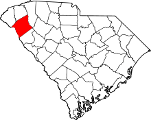 | |
| Towns | ||
| CDPs | ||
| Unincorporated communities | ||
| Footnotes | ‡This populated place also has portions in an adjacent county or counties | |