Chilikadrotna River
| Chilikadrotna River | |
| Country | United States |
|---|---|
| State | Alaska |
| Borough | Lake and Peninsula |
| Source | Twin Lakes |
| - location | Lake Clark National Park and Preserve |
| - elevation | 2,001 ft (610 m) [1] |
| - coordinates | 60°39′58″N 154°02′41″W / 60.66611°N 154.04472°W [2] |
| Mouth | Mulchatna River |
| - location | 46 miles (74 km) northwest of Nondalton |
| - elevation | 850 ft (259 m) [2] |
| - coordinates | 60°35′34″N 155°23′32″W / 60.59278°N 155.39222°WCoordinates: 60°35′34″N 155°23′32″W / 60.59278°N 155.39222°W [2] |
| Length | 55 mi (89 km) [2] |
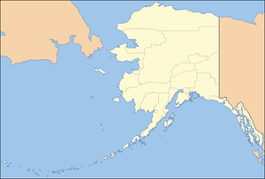 Location of the mouth of the Chilikadrotna River in Alaska
| |
The Chilikadrotna River is a 55-mile (89 km) tributary of the Mulchatna River in the U.S. state of Alaska.[2] It begins in Lake Clark National Park and Preserve in northern Lake and Peninsula Borough and flows westward into the larger river 46 miles (74 km) northwest of Nondalton.[2]
In 1980, the upper 11 miles (18 km) of the river became part of the National Wild and Scenic Rivers System.[3] This segment, rated "wild", lies within the national park.[3]
Recreation
During the months from June to September, the river is generally floatable in 10-to-13-foot (3 to 4 m) rafts or in kayaks by boaters with the necessary skills. Much of the Chilikadrotna River is rated Class II (medium) on the International Scale of River Difficulty, though a stretch about 5 miles (8 km) below the confluence with the Little Mulchatna River is rated Class III (difficult). The river also includes some Class I (easy) water. Dangers include overhanging vegetation, logjams, swift current, and a narrow winding course.[4]
Floatfishing is popular on this river, although Alaska Fishing warns that this is "not a river for inexperienced boaters."[5] There are no formal campgrounds or other accommodations along the river. Game fish on the Chilikadrotna include silver salmon, Arctic grayling, char, rainbow trout, and lake trout.[5]
See also
References
- ↑ Derived by entering source coordinates in Google Earth.
- 1 2 3 4 5 6 "Chilikadrotna River". Geographic Names Information System. United States Geological Survey. January 1, 2000. Retrieved November 21, 2013.
- 1 2 "Chilikadrotna River, Alaska". National Wild and Scenic Rivers System. Retrieved November 21, 2013.
- ↑ Jettmar, Karen (2008) [1993]. The Alaska River Guide: Canoeing, Kayaking, and Rafting in the Last Frontier (3rd ed.). Birmingham, Alabama: Menasha Ridge Press. pp. 154–56. ISBN 978-0-89732-957-6.
- 1 2 Limeres, Rene; Pedersen, Gunnar; et al. (2005). Alaska Fishing: The Ultimate Angler's Guide (3rd ed.). Roseville, California: Publishers Design Group. p. 236. ISBN 1-929170-11-4.
External links
- Rafting on the Chilikadrotna – National Park Service