Chute-Saint-Philippe, Quebec
| Chute-Saint-Philippe | |
|---|---|
| Municipality | |
 | |
 Location within Antoine-Labelle RCM | |
 Chute-Saint-Philippe Location in central Quebec | |
| Coordinates: 46°39′N 75°14′W / 46.650°N 75.233°WCoordinates: 46°39′N 75°14′W / 46.650°N 75.233°W[1] | |
| Country |
|
| Province |
|
| Region | Laurentides |
| RCM | Antoine-Labelle |
| Constituted | October 26, 1940 |
| Government[2] | |
| • Mayor | Normand St-Amour |
| • Federal riding | Laurentides—Labelle |
| • Prov. riding | Labelle |
| Area[2][3] | |
| • Total | 321.40 km2 (124.09 sq mi) |
| • Land | 298.73 km2 (115.34 sq mi) |
| Population (2011)[3] | |
| • Total | 892 |
| • Density | 3.0/km2 (8/sq mi) |
| • Pop 2006-2011 |
|
| • Dwellings | 860 |
| Time zone | EST (UTC−5) |
| • Summer (DST) | EDT (UTC−4) |
| Postal code(s) | J0W 1A0 |
| Area code(s) | 819 |
| Highways |
|
| Website |
www saint-philippe |
Chute-Saint-Philippe is a municipality in the Laurentides region of Quebec, Canada, part of the Antoine-Labelle Regional County Municipality.
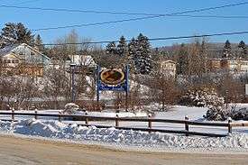
The village is located in a fairly flat valley surrounded by a mountainous area of the Laurentian Hills that are dominated by mixed forest.[1]
History
The settlement initially had the name Chute-Leon at the beginning of the 20th century, in memory of Pope Leo XIII (1810-1903), and was called Victoria Falls by 1903, in honour of Queen Victoria (1819-1901).[1]
In 1921, a mission was founded here with Philip the Apostle as its patron saint. In 1934, the place was renamed to Chute-Saint-Philippe, taking its name from a drop on the Kiamika River and the patron saint. In 1966, the mission received its status as a parish.[1]
Demographics
Population trend:[4]
- Population in 2011: 892 (2006 to 2011 population change: 0.2%)
- Population in 2006: 890
- Population in 2001: 823
- Population in 1996: 778
- Population in 1991: 698
Private dwellings occupied by usual residents: 424 (total dwellings: 860)
Mother tongue:
- English as first language: 2.3%
- French as first language: 94.3%
- English and French as first language: 0%
- Other as first language: 3.4%
See also
References
- 1 2 3 4 "Chute-Saint-Philippe (Municipalité)" (in French). Commission de toponymie du Québec. Retrieved 2009-08-26.
- 1 2 Geographic code 79065 in the official Répertoire des municipalités (French)
- 1 2 Statistics Canada 2011 Census - Chute-Saint-Philippe census profile
- ↑ Statistics Canada: 1996, 2001, 2006, 2011 census
External links
-
 Media related to Chute-Saint-Philippe at Wikimedia Commons
 |
Lac-Saint-Paul | |
Lac-Douaire | |
| Ferme-Neuve | |
Rivière-Rouge | ||
| ||||
| | ||||
| Lac-des-Écorces | Lac-Saguay |
| Cities/towns | |
|---|---|
| Municipalities | |
| Villages | |
| Unorganized territories | |
| |