Col de Tende
| Col de Tende | |
|---|---|
|
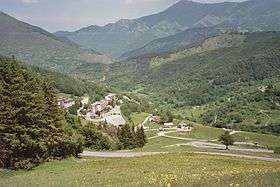
Switchbacks on the pass road | |
| Elevation | 1,870 m (6,135 ft) |
| Traversed by | road |
| Location | Alpes-Maritimes / Province of Cuneo |
| Range | Maritime Alps, Ligurian Alps |
| Coordinates | 44°8′57″N 7°33′43″E / 44.14917°N 7.56194°ECoordinates: 44°8′57″N 7°33′43″E / 44.14917°N 7.56194°E |
 Col de Tende Location of Col de Tende | |
Col de Tende (Italian: Colle di Tenda; elevation 1870 m) is a high mountain pass in the Alps, close to the border between France and Italy, although the highest section of the pass is wholly within France.
It separates the Maritime Alps from the Ligurian Alps. It connects Nice and Tende in Alpes-Maritimes with Cuneo in Piedmont.
A railway tunnel inaugurated in 1898 and a Road Tunnel inaugurated in 1882 run under the pass. The latter tunnel is 3.2 kilometre long and is among the oldest long road tunnels.
French historian François Guizot states that the road was first developed by Phoenicians and later maintained by Greeks and Romans.[1]
But, at the end of three or four centuries, these colonies fell into decay; the trade of the Phoenicians was withdrawn from Gaul, and the only important sign it preserved of their residence was a road which, starting from the eastern Pyrenees, skirted the Gallic portion of the Mediterranean, crossed the Alps by the pass of Tenda, and so united Spain, Gaul, and Italy. After the withdrawal of the Phoenicians this road was kept up and repaired, at first by the Greeks of Marseilles, and subsequently by the Romans.
See also
- List of highest paved roads in Europe
- List of mountain passes
- France–Italy border
- Main chain of the Alps
References
- ↑ A Popular History of France From The Earliest Times, Volume I.
External links
This article is issued from Wikipedia - version of the 11/29/2016. The text is available under the Creative Commons Attribution/Share Alike but additional terms may apply for the media files.