Cold Springs, Oregon
| Cold Springs, Oregon | |
|---|---|
| Unincorporated community | |
 Cold Springs, Oregon Location within the state of Oregon | |
| Coordinates: 45°52′42″N 119°09′56″W / 45.87833°N 119.16556°WCoordinates: 45°52′42″N 119°09′56″W / 45.87833°N 119.16556°W | |
| Country | United States |
| State | Oregon |
| County | Umatilla |
| Elevation | 574 ft (175 m) |
| Time zone | Pacific (PST) (UTC-8) |
| • Summer (DST) | PDT (UTC-7) |
| Area code(s) | 458 and 541 |
| GNIS feature ID | 1158171[1] |
| Coordinates and elevation from Geographic Names Information System | |
Cold Springs is an unincorporated community in Umatilla County, Oregon, United States, south of the Columbia River in the Hermiston area. Cold Springs Junction is a populated place and highway junction about 4 miles (6 km) northeast of Cold Springs at the junction of Oregon Route 37 and U.S. Route 730.[2]
The present-day Cold Springs was a station of the Oregon-Washington Railroad & Navigation Company,[3] which is the Union Pacific Railroad today.[4] Its elevation is 574 feet (175 m).[1]
One of several geographic features in the area—including Cold Springs Wash, Cold Springs Reservoir and Cold Springs Canyon—that were likely named after a local spring, Cold Springs post office was established in 1880 and ran until 1883.[4] It was in the Middle Fork Cold Springs Canyon west of Myrick and east of the reservoir about 28 miles (45 km) northeast of Cold Springs station.[5] The reservoir was formed in the early 1900s when the wash was dammed to provide storage for water diverted from the Umatilla River for irrigation.[4]
See also
References
- 1 2 "Cold Springs". Geographic Names Information System. United States Geological Survey. November 28, 1980. Retrieved December 24, 2009.
- ↑ "Cold Springs Junction". Geographic Names Information System. United States Geological Survey. November 28, 1980. Retrieved December 24, 2009.
- ↑ Avers, Henry G. (1926). "First-Level Ordering in Oregon" (PDF). United States Department of Commerce: U.S. Coast & Geodetic Survey. Retrieved December 24, 2009.
- 1 2 3 McArthur, Lewis A.; Lewis L. McArthur (2003) [1928]. Oregon Geographic Names (7th ed.). Portland, Oregon: Oregon Historical Society Press. p. 217. ISBN 0-87595-277-1.
- ↑ "Cold Springs Post Office (historical)". Geographic Names Information System. United States Geological Survey. August 1, 1994. Retrieved December 24, 2009.
Municipalities and communities of Umatilla County, Oregon, United States | ||
|---|---|---|
| Cities | 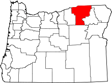 | |
| CDPs | ||
| Other unincorporated communities | ||
| Indian reservation | ||
| Ghost towns | ||