Sunnyside, Umatilla County, Oregon
For other places with the same name, see Sunnyside, Oregon.
| Sunnyside, Oregon | |
|---|---|
| Unincorporated community | |
 Sunnyside, Oregon Location within the state of Oregon | |
| Coordinates: 45°57′44″N 118°24′08″W / 45.96222°N 118.40222°WCoordinates: 45°57′44″N 118°24′08″W / 45.96222°N 118.40222°W | |
| Country | United States |
| State | Oregon |
| County | Umatilla |
| Elevation | 912 ft (278 m) |
| Time zone | Pacific (PST) (UTC-8) |
| • Summer (DST) | PDT (UTC-7) |
| Area code(s) | 458 and 541 |
| GNIS feature ID | 1136801[1] |
| Coordinates and elevation from Geographic Names Information System | |
Sunnyside is an unincorporated community in Umatilla County, Oregon, United States.[1] It is about 3 miles (5 km) north of Milton-Freewater, at the intersection of Oregon Route 332, which is also known as the Sunnyside-Umapine Highway, and Oregon Route 339.[1][2] Sunnyside was once a station on the Walla Walla Valley Railway, which served the local fruit orchards, and the site of a Nebraska Bridge Supply and Lumber Co. planing mill from 1958 to 1963.[3] There was also an Inland Fir Company sawmill.[3]
References
- 1 2 3 "Sunnyside". Geographic Names Information System. United States Geological Survey. November 28, 1980. Retrieved January 6, 2011.
- ↑ Oregon Atlas & Gazetteer (7th ed.). Yarmouth, Maine: DeLorme. 2008. p. 74. ISBN 0-89933-347-8.
- 1 2 "Virtual Tour Part 2". The Virtual Walla Walla Valley Railway. Retrieved January 6, 2011.
Municipalities and communities of Umatilla County, Oregon, United States | ||
|---|---|---|
| Cities | 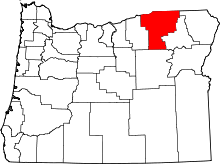 | |
| CDPs | ||
| Other unincorporated communities | ||
| Indian reservation | ||
| Ghost towns | ||
This article is issued from Wikipedia - version of the 9/12/2016. The text is available under the Creative Commons Attribution/Share Alike but additional terms may apply for the media files.