Connecticut Route 160
| ||||
|---|---|---|---|---|
|
Map of Hartford County in northern Connecticut with Route 160 highlighted in red | ||||
| Route information | ||||
| Maintained by ConnDOT | ||||
| Length: | 7.36 mi[1] (11.84 km) | |||
| Existed: | 1932 – present | |||
| Major junctions | ||||
| West end: |
| |||
| East end: |
| |||
| Location | ||||
| Counties: | Hartford | |||
| Highway system | ||||
| ||||

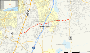
Route 160 is a state highway in Connecticut running for 7.36 miles (11.84 km) from the Berlin Turnpike (US 5 and Route 15) in Berlin to Route 17 in the South Glastonbury section of Glastonbury. The road crosses the Connecticut River on the Rocky Hill - Glastonbury Ferry. It passes over I-91 in Rocky Hill with no interchange.
Route description
Route 160 begins at an intersection with the Berlin Turnpike (US 5/Route 15) in northeastern Berlin and heads east into Rocky Hill. It briefly turns south, overlapping with Route 3 before resuming its eastward direction. It overpasses I-91 without an interchange, and crosses over Route 99. After passing through the center of town, it reaches the shore of the Connecticut River, and crosses it via the Rocky Hill-Glastonbury Ferry. In Glastonbury, it continues east to end at an intersection with Route 17 in South Glastonbury. [2]
Special designations
A 1.06-mile (1.71 km) section of Route 160 in Glastonbury, running from the Connecticut River to Roaring Brook, is designated a scenic road.[3]
History
The Rocky Hill-Glastonbury Ferry began service in 1655. In 1932, it was incorporated into the newly commissioned Route 160. Since then, Route 160 has had no major changes. In 1960, a request by the Town of Glastonbury to extend Route 160 east to the New London Turnpike, near Route 2, was declined by the state.[4]
Junction list
The entire route is in Hartford County.
| Location | mi[1] | km | Destinations | Notes | |||
|---|---|---|---|---|---|---|---|
| Berlin | 0.00 | 0.00 | |||||
| Rocky Hill | 3.21 | 5.17 | Northern end of CT 3 overlap | ||||
| 3.40 | 5.47 | Southern end of CT 3 overlap | |||||
| 5.49 | 8.84 | ||||||
| Connecticut River | 6.09 | 9.80 | Rocky Hill-Glastonbury Ferry | Open April 1-November 30 | |||
| South Glastonbury | 7.36 | 11.84 | Eastern terminus of CT 160 | ||||
1.000 mi = 1.609 km; 1.000 km = 0.621 mi
| |||||||
References
- 1 2 Connecticut State Highway Log Archived 2015-07-26 at WebCite
- ↑ "Archived copy" (PDF). Archived from the original (PDF) on 2015-07-26. Retrieved 2008-02-05.
- ↑ Connecticut Scenic Roads
- ↑ Connecticut Routes, Route 160