Connecticut Route 188
| ||||
|---|---|---|---|---|
|
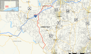
Map of New Haven County in southern Connecticut with Route 188 highlighted in red | ||||
| Route information | ||||
| Maintained by ConnDOT | ||||
| Length: | 15.92 mi[1] (25.62 km) | |||
| Existed: | 1935 – present | |||
| Major junctions | ||||
| South end: |
| |||
|
| ||||
| North end: |
| |||
| Location | ||||
| Counties: | New Haven | |||
| Highway system | ||||
| ||||

Route 188 is a state highway in west-central Connecticut, running in an "L" pattern from Seymour to Middlebury.
Route description
Route 188 begins at an intersection with Route 34 in Seymour on the east shore of the Housatonic River and heads northeast before crossing into Oxford. In Oxford, it heads northwest from its junction with the western end of Route 334 across the town before entering Southbury. In Southbury, it heads north along the Eight Mile River, briefly overlapping with Route 67. It then continues northeast past Waterbury-Oxford Airport to intersect I-84 at Exit 16. It then enters Middlebury, where it turns east at the center of town, briefly overlapping with Route 64 before turning southeast once again. After passing under I-84 without an interchange, Route 188 ends at an intersection with Route 63.[1]
History
Route 187 was commissioned in 1935 from former unsigned state roads, running from the current southern terminus in Seymour to Old Waterbury Road (former Route 135) in Middlebury. In approximately 1943, it was extended to its current northern terminus at Route 63 along the eastern half of former Route 135.[2]
Junction list
The entire route is in New Haven County.
| Location | mi[1] | km | Destinations | Notes | |
|---|---|---|---|---|---|
| Seymour | 0.00 | 0.00 | |||
| 1.23 | 1.98 | ||||
| Southbury | 7.89 | 12.70 | Southern terminus of CT 67 overlap | ||
| 8.03 | 12.92 | Northern terminus of CT 67 overlap | |||
| 10.24 | 16.48 | I-84 Exit 16 | |||
| Middlebury | 12.71 | 20.45 | Western terminus of CT 64 overlap | ||
| 13.25 | 21.32 | Eastern terminus of CT 64 overlap | |||
| 15.92 | 25.62 | Northern terminus of CT 188 | |||
1.000 mi = 1.609 km; 1.000 km = 0.621 mi
| |||||
References
- 1 2 3 Connecticut State Highway Log Archived 2015-07-26 at WebCite
- ↑ Connecticut Routes, Route 188