Connecticut Route 286
| ||||
|---|---|---|---|---|
|
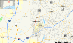
Map of Tolland County in northern Connecticut with Route 286 highlighted in red | ||||
| Route information | ||||
| Maintained by ConnDOT | ||||
| Length: | 3.60 mi[1] (5.79 km) | |||
| Existed: | 1963 – present | |||
| Major junctions | ||||
| South end: |
| |||
| North end: |
| |||
| Highway system | ||||
| ||||

Route 286 is a minor state highway in northern Connecticut running entirely within the town of Ellington. It serves the community of Windermere Village.
Route description
Route 286 begins as Pinney Street at an intersection with Route 74 in southern Ellington. It heads north 2.6 miles (4.2 km) to the Ellington town center, passing by the residential community of Windermere Village along the way. In Ellington center, Route 286 turns east along Main Street, approaching but not intersecting Route 140 at the town green. Route 286 continues east another 0.6 miles (0.97 km) before ending at an intersection with Route 83.[1][2]
History
Most of modern Route 286 was first designated as a state highway at the beginning of 1963 as part of the Route Reclassification Act. The Main Street portion of Route 286 was originally part of Route 140. Route 140 was extended eastward in 1963 and was relocated to use Maple Street, with the Main Street portion becoming part of Route 286. Route 286 has had no significant changes since.[3]
Junction list
The entire route is in Ellington, Tolland County.
| mi[1] | km | Destinations | Notes | ||
|---|---|---|---|---|---|
| 0.00 | 0.00 | ||||
| 3.60 | 5.79 | Northern terminus of CT 286 | |||
| 1.000 mi = 1.609 km; 1.000 km = 0.621 mi | |||||