Connecticut Route 31
| ||||
|---|---|---|---|---|
|
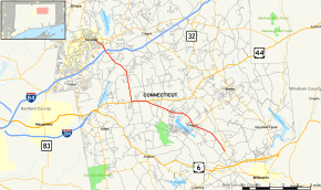
Map of Tolland County in northern Connecticut with Route 31 highlighted in red | ||||
| Route information | ||||
| Maintained by ConnDOT | ||||
| Length: | 14.34 mi[1] (23.08 km) | |||
| Existed: | 1942 (extended 1963) – present | |||
| Major junctions | ||||
| West/North end: |
| |||
|
| ||||
| East/South end: |
| |||
| Location | ||||
| Counties: | Tolland | |||
| Highway system | ||||
| ||||

Route 31 is a north–south state highway in Connecticut running for 14.34 miles (23.08 km) from Route 74 in Vernon to Route 32 in Mansfield. Although it is officially logged as an east-west route, it is signed north-south.
Route description
Route 31 begins at an intersection with Route 74 in Vernon and heads southeast, intersecting Route 30, and I-84 at Exit 67 before crossing into Tolland.[1]
In Tolland, Route 31 continues southeast before turning south briefly before crossing into Coventry. In Coventry, Route 31 continues south to a concurrency with US 44. The two highways run together for slightly more than one mile (1.6 km) before Route 31 heads southeast, crossing Route 275 before continuing into Mansfield.
In Mansfield, Route 31 continues southeast before ending at an intersection with Route 32.
History
The southern part of Route 31 was commissioned as part of the original alignment of US 6 in 1926. In approximately 1938, US 6 was rerouted and the old route was designated US 6A.
In 1942, US 6 was rerouted again and the old US 6A was commissioned as Route 31. In 1963, Route 31 was extended northward to its current route.[2]
Junction list
The entire route is in Tolland County.
| Location | mi[1] | km | Destinations | Notes | |||
|---|---|---|---|---|---|---|---|
| Vernon | 0.00 | 0.00 | |||||
| 0.79 | 1.27 | ||||||
| 1.15 | 1.85 | I-84 exit 67 | |||||
| Coventry | 5.80 | 9.33 | Western terminus of US 44 overlap. | ||||
| 6.90 | 11.10 | Eastern terminus of US 44 overlap. | |||||
| 11.10 | 17.86 | ||||||
| Mansfield | 14.34 | 23.08 | Southern (eastern) terminus of CT 31 | ||||
| 1.000 mi = 1.609 km; 1.000 km = 0.621 mi | |||||||
References
- 1 2 3 Connecticut State Highway Log Archived 2015-07-26 at WebCite
- ↑ Connecticut Routes, Route 31
External links
![]() Media related to Connecticut Route 31 at Wikimedia Commons
Media related to Connecticut Route 31 at Wikimedia Commons