Cooksville Creek
| Cooksville Creek | |
| River | |
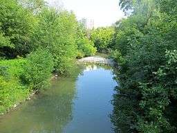 Looking downstream from a pedestrian bridge just downstream of The Queensway | |
| Country | Canada |
|---|---|
| Province | Ontario |
| Region | Greater Toronto Area |
| Regional Municipality | Peel |
| Municipality | Mississauga |
| Part of | Great Lakes Basin |
| Source | |
| - elevation | 183 m (600 ft) |
| - coordinates | 43°37′35″N 79°40′58″W / 43.62639°N 79.68278°W |
| Mouth | Lake Ontario |
| - elevation | 74 m (243 ft) |
| - coordinates | 43°33′53″N 79°33′55″W / 43.56472°N 79.56528°WCoordinates: 43°33′53″N 79°33′55″W / 43.56472°N 79.56528°W |
| Length | 16 km (10 mi) |
| Basin | 33.9 km2 (13 sq mi) |
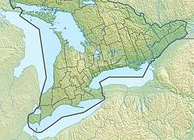 Location of the mouth of Cooksville Creek in southern Ontario
| |
Cooksville Creek is a short stream in Mississauga, Regional Municipality of Peel in the Greater Toronto Area of Ontario, Canada.[1] It begins near Bristol Road West and Hurontario Street and flows south to Lake Ontario at R.K McMilian Park near Lakeshore Road and Cawthra Road. The community of Cooksville is located on the west bank of the creek near Hurontario Street and Dundas Street East. The creek is surrounded mostly by residential homes and a few parks:
- R.K. McMilian Park
- Camilla Park
- Cooksville Park
- R. Jones Park
- Mississauga Valley Park
- Stonebrook Park
- Woodington Green
- Kingsbridge Common
The drainage basin runs for 16 kilometres (9.9 mi), is about 2 kilometres (1.2 mi) wide, has a total area of 33.9 square kilometres (13.1 sq mi),[2] and takes excess water from sanitary and storm sewers.[3] 94% of the drainage basin is built over, and only 6% is open space.[2]
References
- ↑ "Cooksville Creek". Geographical Names Data Base. Natural Resources Canada. Retrieved 2014-04-16.
- 1 2 Aquafor Beech (July 2012). "Cooksville Creek Flood Evaluation - Master Plan EA - Final Report" (PDF). City of Mississauga. Retrieved 16 April 2014.
- ↑ "Public Information Meeting - Cooksville Creek Flooding Issues" (PDF). City of Mississauga. 9 November 2009. Retrieved 16 April 2014.
Great Lakes of North America | ||
|---|---|---|
| Main lakes | 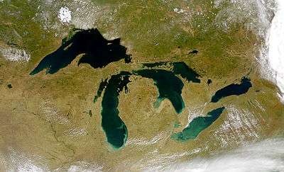 | |
| Secondary lakes | ||
| Bays and Waterways |
| |
| Islands | ||
| Historic geology | ||
| Government | ||
| Related topics |
| |
This article is issued from Wikipedia - version of the 7/28/2014. The text is available under the Creative Commons Attribution/Share Alike but additional terms may apply for the media files.