Coromandel, New Zealand
| Coromandel | |
|---|---|
 Coromandel | |
| Coordinates: 36°45′18″S 175°30′8″E / 36.75500°S 175.50222°E | |
| Country | New Zealand |
| Region | Waikato |
| District | Thames-Coromandel District |
| Postcode(s) | 3506 |
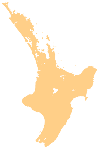
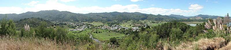
Coromandel is a town on the Coromandel Harbour, on the western side of the Coromandel Peninsula, which is on the east coast of the North Island of New Zealand. It is 75 kilometres east of the city of Auckland, although the road between them, which winds around the Firth of Thames and Hauraki Gulf coasts, is 190 km long.
The population was 1,660 as of June 2016[1].
The town was named after the peninsula, which was named after HMS Coromandel, which sailed into the harbour in 1820.[2] At one time Coromandel Harbour was a major port serving the peninsula's gold mining and kauri industries. An old gold stamper battery is still in fully operational working order. Today, the town's main industries are tourism and mussel farming.
Coromandel Harbour is a wide bay on the Hauraki Gulf guarded by several islands, the largest of which is Whanganui Island.
The town and environs are a popular summer holiday destination for New Zealanders. Coromandel is noted for its artists, crafts, alternative lifestylers, mussel farming, and recreational fishing. One of the most popular tourist attractions is the Driving Creek Railway.
Education
Coromandel Area School is a co-educational state composite (years 1-13) school with a decile rating of 3 and a roll of 304.[3]
Coromandel Rudolf Steiner School was a small private full primary (years 1-8) school. It closed at the end of 2007.[4]
References
- ↑ "Subnational Population Estimates: At 30 June 2016 (provisional)". Statistics New Zealand. 21 October 2016. Retrieved 21 October 2016. For urban areas, "Subnational population estimates (UA, AU), by age and sex, at 30 June 1996, 2001, 2006-16 (2017 boundary)". Statistics New Zealand. 21 October 2016. Retrieved 21 October 2016.
- ↑ "HMS Coromandel". Early shipping in New Zealand waters. Retrieved 10 November 2013.
- ↑ "Te Kete Ipurangi - Coromandel Area School". Ministry of Education.
- ↑ "School Closures, Mergers and New: December_2008: Te Kete Ipurangi - Coromandel Rudolf Steiner School" (XLS). Education Counts.
- Reed, A. W. (2002). The Reed Dictionary of New Zealand Place Names. Auckland: Reed Books. ISBN 0-7900-0761-4.
External links
![]() Coromandel travel guide from Wikivoyage
Coromandel travel guide from Wikivoyage
Coordinates: 36°46′S 175°30′E / 36.767°S 175.500°E