County Route 545 (New Jersey)
| ||||
|---|---|---|---|---|
|
CR 545 highlighted in red, dotted line represents closed section | ||||
| Route information | ||||
| Length: | 14.76 mi[1] (23.75 km) | |||
| Major junctions | ||||
| South end: |
| |||
|
| ||||
| North end: |
| |||
| Location | ||||
| Counties: | Burlington | |||
| Highway system | ||||
| ||||

_map.svg.png)
County Route 545, abbreviated CR 545, is a county highway in the U.S. state of New Jersey. The highway extends 14.76 miles (23.75 km) from Lakehurst Road (CR 530) in Pemberton Township to Park Avenue in Bordentown. There is a 3.38-mile (5.44 km) stretch from Pemberton Boulevard at the Pemberton Township/New Hanover border to Rexall Avenue in Wrightstown that is permanently closed to the general public because of security restrictions in Fort Dix and McGuire AFB.[2]
Route description

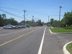

CR 545 begins at an intersection with CR 530 in the community of Browns Mills in Pemberton Township, heading north-northwest on two-lane undivided Trenton Road. The road passes a mix of homes and businesses, crossing CR 667. The route runs to the west of Deborah Heart and Lung Center before entering wooded areas with residences located along the east side of the road as it enters the grounds of Fort Dix within New Hanover Township and becomes Texas Avenue. After the Range Road intersection, CR 545 reaches a gate into Fort Dix, at which point the general public is prohibited from the road. Along this stretch, the road runs between Fort Dix buildings to the west and McGuire Air Force Base to the east. After a traffic light with an unnamed road, the route becomes Wrightstown Road and intersects CR 616 at a traffic circle, making a turn to the north.[1][3]
Crossing into Wrightstown, CR 545 leaves the fort at another gate, where the road is accessible to the general public again. The road passes several businesses as Fort Dix Street, crossing CR 616. In North Hanover Township, the route intersects CR 666 and bears northwest onto Wrightstown-Georgetown Road, heading into a mix of farms and homes in Springfield Township. CR 545 reaches a junction with CR 680, at which point the route merges onto a four-lane divided highway that serves as the main access road to McGuire Air Force Base via CR 680. The road crosses CR 537 and narrows back into a two-lane undivided road that turns more to the northwest as it enters Chesterfield Township. The route continues through more areas of farms, woods, and residences as it enters Mansfield Township. Here, CR 545 intersects Bordentown Road, which provides access to Route 68 a short distance to the west, and it makes a turn to the north into more residential areas. A short distance later, the route meets the northern terminus of CR 543 and becomes Bordentown-Georgetown Road.[1][3]
Entering Chesterfield Township again, the road enters more agricultural areas with a few patches of woods, heading north-northwest. Upon crossing CR 660, CR 545 comes into Bordentown Township and enters more residential surroundings, making a turn to the northwest as it passes under the New Jersey Turnpike (I-95). The road has intersections with US 206 and US 130 a short distance apart, with the name becoming Farnsworth Avenue at the intersection with the former. The road continues into Bordentown, where it is municipally maintained and lined with several homes and downtown businesses. In the center of Bordentown, CR 545 has an intersection with the western terminus of CR 528. After crossing a Conrail Shared Assets Operations railroad line, the route reaches its northern terminus at the CR 662 intersection.[1][3]
Major intersections
The entire route is in Burlington County.
| Location | mi[1] | km | Destinations | Notes | |
|---|---|---|---|---|---|
| Pemberton Township | 0.00 | 0.00 | |||
| New Hanover Township | 2.37– 4.83 | 3.81– 7.77 | Fort Dix Road closed to general public since September 11, 2001 | ||
| Springfield Township | 6.94 | 11.17 | |||
| Mansfield Township | 8.47 | 13.63 | |||
| 8.77 | 14.11 | Northern terminus of CR 543 | |||
| Bordentown Township | 13.78 | 22.18 | |||
| 14.05 | 22.61 | ||||
| Bordentown | 14.57 | 23.45 | Western terminus of CR 528 | ||
| 14.76 | 23.75 | ||||
1.000 mi = 1.609 km; 1.000 km = 0.621 mi
| |||||
See also
 U.S. Roads portal
 New Jersey portal
References
- 1 2 3 4 5 NJDOT County Route 545 Straight Line Diagram (PDF) (NJDOT) (Straight line diagram)
- ↑ "Installation Access Update (Fort Dix press release)". May 24, 2002. Archived from the original on February 19, 2007. Retrieved December 27, 2014.
- 1 2 3 Google (2010-04-20). "overview of County Route 545" (Map). Google Maps. Google. Retrieved 2010-04-20.