Cringle Moor
| Cringle Moor | |
|---|---|
 Cringle Moor seen from the east | |
| Highest point | |
| Elevation | 432 m (1,417 ft) |
| Prominence | 177 m (581 ft) |
| Listing | Marilyn |
| Geography | |
| Location | North York Moors, England |
| OS grid | NZ537029 |
| Topo map | OS Landranger 93 |
Cringle Moor, at 432 m (1,417 ft), is the third highest hill in the North York Moors, England, and the highest point west of Clay Bank.
The hill is crossed by the Cleveland Way National Trail and is a part of Wainwright's Coast to Coast Walk, which also passes over the neighbouring tops of Cold Moor, Carlton Moor, Live Moor and Hasty Bank — a section of the walk which Alfred Wainwright described as "one of the finest". It is also part of the Lyke Wake Walk.
Gallery
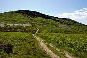
 Cringle Moor from Bank Lane
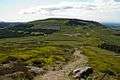 Cringle Moor from Cold Moor
 Cringle Moor's northern face
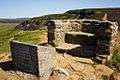 Stone seat on Cringle Moor
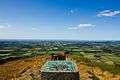 View north from Cringle Moor
Coordinates: 54°25′07″N 1°10′26″W / 54.41871°N 1.17397°W
Marilyns of Northern England | ||
|---|---|---|
| 1. Northumberland | 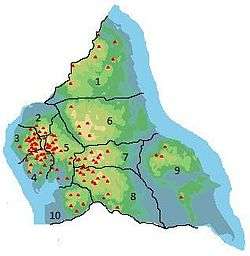 | |
| 2. Northern Lakeland | ||
| 3. Western Lakeland | ||
| 4. Central and Southern Lakeland | ||
| 5. Eastern Lakeland | ||
| 6. North Pennines and Durham | ||
| 7. Northern Yorkshire Dales | ||
| 8. Southern Yorkshire Dales | ||
| 9. North York Moors to the Humber | ||
| 10. Forest of Bowland | ||
| Wikimedia Commons has media related to Cringle Moor. |
This article is issued from Wikipedia - version of the 9/9/2016. The text is available under the Creative Commons Attribution/Share Alike but additional terms may apply for the media files.