Cuilco
| Cuilco la perla escondida | |
|---|---|
| Municipality | |
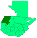
 Cuilco Location in Guatemala | |
| Coordinates: 15°24′25″N 91°56′45″W / 15.40694°N 91.94583°W | |
| Country |
|
| Department |
|
| Municipality | Cuilco |
| Government | |
| • Type | Municipal |
| Area | |
| • Municipality | 592 km2 (229 sq mi) |
| Elevation | 1,150 m (3,770 ft) |
| Highest elevation | 3,300 m (10,800 ft) |
| Lowest elevation | 1,000 m (3,000 ft) |
| Population (Census 2002)[1] | |
| • Municipality | 46,407 |
| • Urban | 1,611 |
| • Ethnicities | Mam, Ladino, Tektitek |
| • Religions | Roman Catholicism, Evangelicalism, Maya |
| Climate | Am |
| Website | http://www.inforpressca.com/cuilco/ |
Cuilco is a municipality in the Guatemalan department of Huehuetenango. It is located in the Cuchumatanes mountains in the Southwestern portion of Huehuetenango. In 2007 it served approximately 50,000 people, most of them of Maya Mam descent, living in over 100 aldeas and caserios, which are smaller communities served by the municipality.
The municipality covers a total area of 592 km2. The dirt road connecting it to the Pan-American Highway has recently been improved and asphalted, which reduces travel times considerably. However, the highway ends at Cuilco, so travellers wishing to continue on to other parts of Guatemala or to Mexico still must navigate rough dirt roads. Given the poor condition of municipal roads, travel times may exceed 8 hours from one side to the other. Export crops include corn, coffee and panela. Panela is a molasses-like substance made from processing sugar cane.
Cuilco, as the municipality's head town, contains the municipal government housed in the municipal building near the center plaza of town. As of 2007, the municipal building ("muni") employed approximately 15 people, providing many services to the surrounding villages and to Cuilco itself.
Tourism to Cuilco is fairly limited given its location more than 2 hours from Huehuetenango. The majority of Cuilco speak Spanish, the mayan language isn't spoken as much as it used to be before.
References
Coordinates: 15°24′N 91°58′W / 15.400°N 91.967°W