Curlew National Grassland
| Curlew National Grassland | |
|---|---|
|
IUCN category VI (protected area with sustainable use of natural resources) | |
|
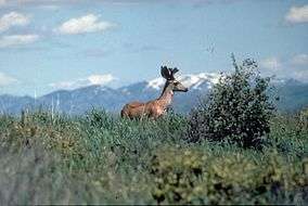
Mule Deer at Curlew National Grassland | |
 | |
| Location | Oneida and Power counties, Idaho, United States |
| Nearest city | Malad City, ID |
| Coordinates | 42°11′15″N 112°41′57″W / 42.1876°N 112.6991°W[1]Coordinates: 42°11′15″N 112°41′57″W / 42.1876°N 112.6991°W[2] |
| Area | 47,790 acres (19,340 ha)[3] |
| Established | 1934 |
| Governing body | U.S. Forest Service |
| Website | Curlew National Grassland |
Curlew National Grassland is a National Grassland located in Oneida and Power counties in the state of Idaho, USA. It has a land area of 47,790 acres (19,340 ha).[3] The land used to make the grassland was purchased between the years 1934 and 1942. The primary goal of the grassland was to improve soil and vegetation in the area. The grassland is administered by the Forest Service together with the Caribou-Targhee National Forest from common headquarters located in Idaho Falls, Idaho. There are local ranger district offices in Malad City.[4][5]
References
- ↑ "Curlew National Grassland". Geographic Names Information System. United States Geological Survey. Retrieved December 9, 2012.
- ↑ "Curlew National Grassland". Geographic Names Information System. United States Geological Survey. Retrieved December 9, 2012.
- 1 2 "Land Areas of the National Forest System". U.S. Forest Service. January 2013. Retrieved December 9, 2012.
- ↑ "Caribou-Targhee National Forest". U.S. Forest Service. Retrieved December 9, 2012.
- ↑ "Curlew National Grassland". U.S. Forest Service. Retrieved December 9, 2012.
External links
 Media related to Curlew National Grassland at Wikimedia Commons
- Curlew National Grassland - U.S. Forest Service
- Map of Curlew National Grassland - Idaho Fish and Game
This article is issued from Wikipedia - version of the 11/19/2016. The text is available under the Creative Commons Attribution/Share Alike but additional terms may apply for the media files.