Currawang Parish
| Currawang Parish New South Wales | |||||||||||||
|---|---|---|---|---|---|---|---|---|---|---|---|---|---|
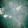 Currawang area from space, November 1985 | |||||||||||||
| LGA(s) | Goulburn Mulwaree | ||||||||||||
| County | Argyle | ||||||||||||
| Division | Eastern | ||||||||||||
| |||||||||||||
The Parish of Currawang is a parish of Argyle County located to the north of Lake George. The parish was formerly known as the parish of Currowang, the former name discontinued on 14 November 1980[1] and the present name assigned.[2]
The parish located at Latitude -34°58'59.99" and Longitude 149°30'59.99" is roughly equivalent to the suburb of Currowang.
History
The area of Currawang was first inhabited by the Gundungurra people,who called the area Werriwa, and who were apparently badly affected by influenza in 1846/47.
In the mid 1840s the NSW colonial government granted numerous land grants in area, beginning white settlement.
Copper was soon discovered,[3] as was gold, 7km to the west, and a town of Currawang soon sprung up.[4] The town had a post office, shops, primary school and two churches. The post office operated from 1866 and which was closed on 31 March 1962 while the Currawang Public School operated from 1870 till 1944. The mines closed in the 1990s and today only the Catholic(Hermitage) and Protestant(St. Matthias) church buildings remain.
Currawang Today
Pastoralism remains the dominant part of the economy, however employment also comes from the waste management facilities reusing the former mine sites, and the recently constructed Capital Wind Farm. There is still an active Rural Fire Service Brigade.
Images
-
Lake George from space, November 1985
-
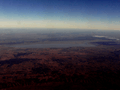
August 2010, aerial view looking northwest over the wind farm.
-
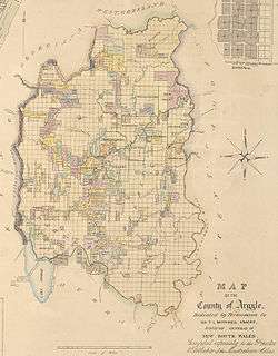
1840s map of the County of Argyle
-

Currowang in the distance
Notable residents
References
- ↑ "Currowang". Geographical Names Register (GNR) of NSW. Geographical Names Board of New South Wales. Retrieved 4 August 2013.
- ↑ "Currawang". Geographical Names Register (GNR) of NSW. Geographical Names Board of New South Wales. Retrieved 4 August 2013.
- ↑ McGOWAN, Barry. "A Social History of Currawang 1865-1885." Canberra Historical Journal. NS, No.32, September 1993.
- ↑ BARRY McGOWAN, Hegemony, localism and ethnicity: The ‘Welsh’ mining communities of Currawang and Frogmore in southern New South Wales. Journal of Australasian Mining History Volume 5 September 2007.
Coordinates: 35°00′S 149°30′E / 35.000°S 149.500°E