Cut Bank Municipal Airport
| Cut Bank Municipal Airport Cut Bank Army Air Field | |||||||||||||||
|---|---|---|---|---|---|---|---|---|---|---|---|---|---|---|---|
|
2006 USGS Photo | |||||||||||||||
| IATA: CTB – ICAO: KCTB – FAA LID: CTB | |||||||||||||||
| Summary | |||||||||||||||
| Airport type | Public | ||||||||||||||
| Owner | Cut Bank and Glacier County | ||||||||||||||
| Serves | Cut Bank, Montana | ||||||||||||||
| Location | Glacier County, near Cut Bank, Montana | ||||||||||||||
| Elevation AMSL | 3,854 ft / 1,175 m | ||||||||||||||
| Coordinates | 48°36′30″N 112°22′34″W / 48.60833°N 112.37611°W | ||||||||||||||
| Website | CutbankAirport.org | ||||||||||||||
| Map | |||||||||||||||
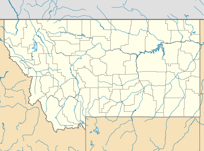 KCTB Location | |||||||||||||||
| Runways | |||||||||||||||
| |||||||||||||||
| Statistics (2008) | |||||||||||||||
| |||||||||||||||
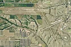
Cut Bank Municipal Airport (IATA: CTB, ICAO: KCTB, FAA LID: CTB) is three miles southwest of Cut Bank, in Glacier County, Montana. It is owned by Cut Bank and Glacier County.[1]
The airport's website calls it Cut Bank International Airport. Its first flight was on 1 June 1941.[2]
Facilities
Cut Bank Municipal Airport covers 1,730 acres (700 ha) at an elevation of 3,854 feet (1,175 m). It has two asphalt runways: 5/23 is 5,299 by 75 feet (1,615 x 23 m) and 13/31 is 5,300 by 75 feet (1,615 x 23 m).[1]
In the year ending August 22, 2008 the airport had 5,800 aircraft operations, average 15 per day: 90% general aviation, 9% air taxi and 2% military. 32 aircraft were then based at the airport: 88% single-engine, 3% multi-engine and 9% ultralight.[1]
History
During World War II Cut Bank Army Air Field was used by the Second Air Force as an auxiliary heavy bomber training airfield, being controlled by Great Falls Army Air Base. Several squadrons of groups training at Great Falls in B-17 Flying Fortresses trained at Cut Bank. Known squadrons were:
- 2nd Bombardment Group, 429th Bomb Squadron, November 1942-March 1943
- 385th Bombardment Group, 550th Bomb Squadron, March–June 1943
- 390th Bombardment Group, 569th Bomb Squadron, June–July 1943
- 401st Bombardment Group, 613th Bomb Squadron, July–October 1943
During the Cold War Cut Bank AFB was an interceptor base, part of Air Defense Command.
See also
References
![]() This article incorporates public domain material from the Air Force Historical Research Agency website http://www.afhra.af.mil/.
This article incorporates public domain material from the Air Force Historical Research Agency website http://www.afhra.af.mil/.
- 1 2 3 4 FAA Airport Master Record for CTB (Form 5010 PDF), effective 2008-09-25.
- ↑ "Airport History". Cut Bank Airport. Retrieved November 26, 2011.
External links
- Cut Bank International Airport, official site
- FAA Terminal Procedures for CTB, effective November 10, 2016
- Resources for this airport:
- FAA airport information for CTB
- AirNav airport information for KCTB
- ASN accident history for CTB
- FlightAware airport information and live flight tracker
- NOAA/NWS latest weather observations
- SkyVector aeronautical chart, Terminal Procedures