Davis Field (Oklahoma)
| Davis Field (former Muskogee Army Airfield) | |||||||||||||||||||
|---|---|---|---|---|---|---|---|---|---|---|---|---|---|---|---|---|---|---|---|
|
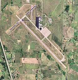
USGS 2006 orthophoto | |||||||||||||||||||
| IATA: MKO – ICAO: KMKO – FAA LID: MKO | |||||||||||||||||||
| Summary | |||||||||||||||||||
| Airport type | Public | ||||||||||||||||||
| Owner | City of Muskogee | ||||||||||||||||||
| Serves | Muskogee, Oklahoma | ||||||||||||||||||
| Elevation AMSL | 611 ft / 186 m | ||||||||||||||||||
| Coordinates | 35°39′28″N 095°21′42″W / 35.65778°N 95.36167°WCoordinates: 35°39′28″N 095°21′42″W / 35.65778°N 95.36167°W | ||||||||||||||||||
| Map | |||||||||||||||||||
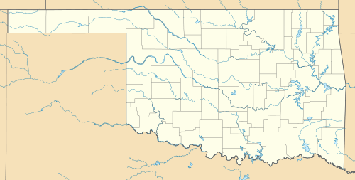
 MKO Location in Oklahoma | |||||||||||||||||||
| Runways | |||||||||||||||||||
| |||||||||||||||||||
| Statistics (2008) | |||||||||||||||||||
| |||||||||||||||||||
Davis Field (IATA: MKO, ICAO: KMKO, FAA LID: MKO) is a city owned airport seven miles south of Muskogee, in Muskogee County, Oklahoma.[1] The National Plan of Integrated Airport Systems for 2011–2015 called it a general aviation facility.[2]
The airport can accommodate light through heavy transport jet aircraft. It is open 24 hours and is attended 6:00 a.m. to 7:00 p.m. with after hours service on request.
Facilities
Davis Field covers 1,440 acres (583 ha) at an elevation of 611 feet (186 m). It has three runways: 13/31 is 7,202 by 150 feet (2,195 x 46 m) asphalt; 4/22 is 4,498 by 75 feet (1,371 x 23 m) asphalt/concrete; 18/36 is 1,904 by 60 feet (580 x 18 m) asphalt.[1]
In the year ending August 5, 2008 the airport had 8,500 aircraft operations, average 23 per day: 80% general aviation and 20% military. 58 aircraft were then based at the airport: 86% single-engine, 9% multi-engine, 3% helicopter, and 2% ultralight.[1]
Davis Field Aviation is the fixed-base operator (FBO). Hours of operation are 8:00 a.m. to 6:00 p.m. seven days a week. Jet fuel as well as full/self serve Avgas are available.
References
- 1 2 3 4 FAA Airport Master Record for MKO (Form 5010 PDF). Federal Aviation Administration. Effective May 31, 2012.
- ↑ "2011–2015 NPIAS Report, Appendix A" (PDF, 2.03 MB). National Plan of Integrated Airport Systems. Federal Aviation Administration. October 4, 2010. External link in
|work=(help)
External links
- Encyclopedia of Oklahoma History and Culture - Davis Field
- Davis Field Aviation, the fixed-base operator (FBO)
- Aerial image as of March 1995 from USGS The National Map
- FAA Terminal Procedures for MKO, effective November 10, 2016
- Resources for this airport:
- FAA airport information for MKO
- AirNav airport information for KMKO
- ASN accident history for MKO
- FlightAware airport information and live flight tracker
- NOAA/NWS latest weather observations
- SkyVector aeronautical chart, Terminal Procedures
