Deale, Maryland
| Deale, Maryland | |
|---|---|
| Census-designated place | |
|
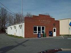
The U.S. Post Office in Deale, Maryland, in March 2010 | |
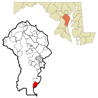 Location of Deale, Maryland | |
| Coordinates: 38°47′30″N 76°32′20″W / 38.79167°N 76.53889°WCoordinates: 38°47′30″N 76°32′20″W / 38.79167°N 76.53889°W | |
| Country |
|
| State |
|
| County |
|
| Area | |
| • Total | 5.9 sq mi (15.4 km2) |
| • Land | 5.3 sq mi (13.7 km2) |
| • Water | 0.7 sq mi (1.7 km2) |
| Elevation | 7 ft (2 m) |
| Population (2010) | |
| • Total | 4,945 |
| • Density | 936/sq mi (361.2/km2) |
| Time zone | Eastern (EST) (UTC-5) |
| • Summer (DST) | EDT (UTC-4) |
| ZIP code | 20751 |
| Area code(s) | 410 |
| FIPS code | 24-22050 |
| GNIS feature ID | 0590075 |
Deale is a census-designated place (CDP) in Anne Arundel County, Maryland, United States. The population was 4,945 at the 2010 census.[1] It has a scenic view of Chesapeake Bay and is popular with boaters. Sudley was listed on the National Register of Historic Places in 1973.[2]
Geography
Deale is located at 38°47′30″N 76°32′20″W / 38.79167°N 76.53889°W (38.791766, -76.538933).[3]
According to the United States Census Bureau, the CDP has a total area of 5.9 square miles (15.4 km2), of which 5.3 square miles (13.7 km2) is land and 0.66 square miles (1.7 km2), or 11.01%, is water.
Deale is a waterfront fishing village located on the Western Shore of Chesapeake Bay. Four tidal creeks are located in Deale that flow into the bay: Rockhold Creek, Parker Creek, Carrs Creek, and Broadwater Creek. Rockhold Creek is the most commercial of the creeks and is home to several marinas and most of the charter fishing boats. Happy Harbor Restaurant, one of Deale's most famous landmarks, is located on Rockhold Creek.
Demographics
As of the census[4] of 2010, there were 4,945 people, 1,778 households, and 1,313 families residing in the CDP. The population density was 1,105.0 people per square mile (426.7/km²). There were 1,942 housing units at an average density of 447.4/sq mi (172.8/km²). The racial makeup of the CDP was 91.89% White, 6.01% African American, 0.10% Native American, 0.44% Asian, 0.06% Pacific Islander, 0.15% from other races, and 1.36% from two or more races. Hispanic or Latino of any race were 1.06% of the population.
There were 1,778 households out of which 35.6% had children under the age of 18 living with them, 59.4% were married couples living together, 10.5% had a female householder with no husband present, and 26.1% were non-families. 19.7% of all households were made up of individuals and 7.2% had someone living alone who was 65 years of age or older. The average household size was 2.70 and the average family size was 3.11.
In the CDP the population was spread out with 26.4% under the age of 18, 6.1% from 18 to 24, 32.7% from 25 to 44, 25.5% from 45 to 64, and 9.3% who were 65 years of age or older. The median age was 38 years. For every 100 females there were 98.8 males. For every 100 females age 18 and over, there were 97.3 males.
The median income for a household in the CDP was $66,016, and the median income for a family was $73,708. Males had a median income of $41,219 versus $32,708 for females. The per capita income for the CDP was $26,214. About 1.9% of families and 3.7% of the population were below the poverty line, including 4.6% of those under age 18 and 2.7% of those age 65 or over.
Media
Deale is home to WRYR-LP, a low power community radio station owned and operated by the South Arundel Citizens for Responsible Development (SACReD). The station was built by numerous volunteers from Deale and around the region in February 2002 at the first Prometheus Radio Project barnraising. WRYR broadcasts music, news, and public affairs to listeners at 97.5FM.
Natives
John and T.J. Osborne, who comprise the duo Brothers Osborne, are natives of Deale.[5]
References
- ↑ "Geographic Identifiers: 2010 Demographic Profile Data (G001): Deale CDP, Maryland". U.S. Census Bureau, American Factfinder. Retrieved May 30, 2013.
- ↑ National Park Service (2008-04-15). "National Register Information System". National Register of Historic Places. National Park Service.
- ↑ "US Gazetteer files: 2010, 2000, and 1990". United States Census Bureau. 2011-02-12. Retrieved 2011-04-23.
- ↑ "American FactFinder". United States Census Bureau. Retrieved 2008-01-31.
- ↑ "Bubbling Under: The Colourist Breaks Through At Alternative". Billboard. 6 September 2013. Retrieved 18 October 2013.
External links
- Deale, Maryland at DMOZ
- Deale Volunteer Fire Department & Rescue Squad
- Deale Area Historical Society
- "Hooked on the Bay Lifestyle in Deale", The Washington Post, Aug. 16, 2003
