Delvinaki
| Delvinaki Δελβινάκι | |
|---|---|
 Delvinaki | |
|
Location within the regional unit 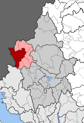 | |
| Coordinates: 39°56′N 20°28′E / 39.933°N 20.467°ECoordinates: 39°56′N 20°28′E / 39.933°N 20.467°E | |
| Country | Greece |
| Administrative region | Epirus |
| Regional unit | Ioannina |
| Municipality | Pogoni |
| Districts | 17 |
| • Municipal unit | 255.835 km2 (98.778 sq mi) |
| Population (2011)[1] | |
| • Municipal unit | 2,540 |
| • Municipal unit density | 9.9/km2 (26/sq mi) |
| Community[1] | |
| • Population | 772 (2011) |
| • Area (km2) | 54.824 |
| Time zone | EET (UTC+2) |
| • Summer (DST) | EEST (UTC+3) |
| Postal code | 440 04 |
| Vehicle registration | IN |
Delvinaki (Greek: Δελβινάκι) is a former municipality in the Ioannina regional unit, Epirus, Greece. Since the 2011 local government reform it is part of the municipality Pogoni, of which it is a municipal unit.[2] The municipal unit has an area of 255.835 km2, the community 54.824 km2.[3] In 2011 its population was 772 for the village and 2,540 for the municipal unit. Delvinaki is part of the traditional area Pogoni.
Delvinaki is situated on the road GR-22/E853 which links Kalpaki with the Albanian border. The border crossing Kakavia is west of town.
Subdivisions
The municipal unit Delvinaki is subdivided into the following communities (constituent villages in brackets):
- Agia Marina
- Argyrochori
- Charavgi
- Delvinaki
- Farangi
- Kastani
- Kerasovo
- Kryoneri
- Ktismata (Ktismata, Neochori)
- Limni
- Mavropoulo (Mavropoulo, Zavrocho, Chrysodouli)
- Oreino Xirovaltou (Oreino, Xirovaltos)
- Peristeri
- Pontikates
- Stratinista
- Teriachi (Teriachi, Stavrodromi)
- Vissani
Population
| Year | Village population | Municipal unit population |
|---|---|---|
| 1981 | 884 | - |
| 1991 | 922 | - |
| 2001 | 751 | 2,933 |
| 2011 | 772 | 2,540 |
History
Delvinaki joined Greece after the Balkan Wars of 1913.
Notable people
- Petroloukas Chalkias, musician.
- Hatzimichalis Dalianis, hero of the Greek War of Independence.
- Evangelos Psimmas, (1905–1962), bishop of Ermoupoli.
- Konstantinos Iroklis Vasiadis, (1821–1890), scholar.
See also
References
- 1 2 "Απογραφή Πληθυσμού - Κατοικιών 2011. ΜΟΝΙΜΟΣ Πληθυσμός" (in Greek). Hellenic Statistical Authority.
- ↑ Kallikratis law Greece Ministry of Interior (Greek)
- ↑ "Population & housing census 2001 (incl. area and average elevation)" (PDF) (in Greek). National Statistical Service of Greece.
External links
 |
Pogon (Albania) | Pogoniani | Ano Pogoni | |
| Dropull i Poshtëm (Albania) | |
Kalpaki | ||
| ||||
| | ||||
| Dropull i Sipërm (Albania) | Filiates and Lavdani | Ano Kalamas |
This article is issued from Wikipedia - version of the 12/1/2016. The text is available under the Creative Commons Attribution/Share Alike but additional terms may apply for the media files.