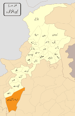
Dera Ismail Khan District
| Dera Ismail Khan District | |
|---|---|
| District | |
.svg.png) Khyber Pakhtunkhwa's location in the Pakistan | |
| Country | Pakistan |
| Province | Khyber Pakhtunkhwa |
| Language | Pashto and Seraiki |
| Headquarters | Dera Ismail Khan |
| Area | |
| • Total | 7,326 km2 (2,829 sq mi) |
| Population (2014) | |
| • Total | 1,939,000 |
| • Density | 116/km2 (300/sq mi) |
| Time zone | PST (UTC+5) |
Dera Ismail Khan (Pashto/Urdu: ضلع دېره اسماعیل خان, ; often abbreviated as D.I. Khan) is the most southern of the 26 districts in the Khyber Pakhtunkhwa province of Pakistan. The capital of the district is the town of Dera Ismail Khan. The district has an area of 7,326 km2 (2,829 sq mi) and a population of 852,995 as of the 1998 Census.
Location
The district of Dera Ismail Khan is bounded on the east by the Bhakkar and Dera Ghazi Khan districts of Punjab, to the southwest by South Waziristan district, and to the northwest by Tank and Lakki Marwat districts.
History
The founder of Dera Ismail Khan was Sardar Ismail Khan Baloch son of Sardar Sohrab Khan Baloch.Who named it as Dera Ismail Khan after saving this land of Saraiki from pawanda(pashtun) attacks and its language is also saraiki.
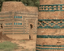
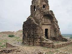
Dera Ismail Khan was created as an administrative unit of British India, part of the Derajat Division of the North-West Frontier Province, because it is and has historicaly been Pashtun land. It was formerly divided into two almost equal portions by the Indus River, which intersected it from north to south. To the west of the Indus the characteristics of the country resembled those of Dera Ghazi Khan. This region is inhabited by ethnic Pashtuns. To the east of the present bed of the river there is a wide tract known as the Kachi, exposed to river action. Beyond this, the country rises abruptly, and a barren, almost desert plain stretches eastwards, sparsely cultivated, and inhabited by nomadic tribes of Pashtun herdsmen. In 1901 the trans-Indus tract was allotted to the newly formed North-West Frontier Province, the cis-Indus tract remaining in the Punjab jurisdiction. The cis-Indus portions of the Dera Ismail Khan and Bannu districts now comprise the new Punjab district of Mianwali which is inhabited primarily by Saraikies. Wheat and wool were exported. In 1901 it contained an area of 8,814 km2 (3,403 sq mi) and a population of 252,379, claimed to be majority Saraiki Muslims because it is originally a Balouch territory. In 1947 it became part of the newly independent Pakistan(By Nisar Chishti). The predominantly Muslim population supported Muslim League and Pakistan Movement. After the independence of Pakistan in 1947, the minority immigrant Hindus and Sikhs migrated to India.
Politics
The district is represented in the National assembly by Two elected MNAs who represent the following constituencies:[1]
| Constituency | MNA | Party |
|---|---|---|
| NA-24 DERA ISMAIL KHAN-CUM-TANK | Maulana Fazal-ur-Rehman | JUI(F) |
| NA-25 DERA ISMAIL KHAN(Tank) | Dawar kundi | PTI |
The district is represented in the provincial assembly by five elected MPAs who represent the following constituencies:[1]
| Constituency | MPA | Party |
|---|---|---|
| PK-64 (Dera Ismail Khan-1) | Ali Amin Khan | PTI |
| PK-65 (Dera Ismail Khan-2) | Sami Ullah Khan Alazai | AZAD |
| PK-66 (Dera Ismail Khan-3) | Maulana Lutf Ur Rehman | JUI |
| PK-67 (Dera Ismail Khan-4) | Ikram ullah Khan Gandapur | PTI |
| PK-68 (Dera Ismail Khan-5) | Ehtsham Javeed Akber Khan | PTI |
Administration
The district is subdivided into five tehsils which contain a total of 47 Union Councils:[2]
| Name of tehsil | No. of Unions |
|---|---|
| Dera Ismail Khan | 21 |
| Kulachi | 4 |
| Darabin | 4 |
| Paroa | 7 |
| Paharpur | 11 |
See also
References
Coordinates: 32°00′N 70°30′E / 32.000°N 70.500°E