Administrative units of Pakistan
| Administrative units of Pakistan پاکستان کی انتظامی اکائیاں (Urdu) | |
|---|---|
|
Also known as: Muhafazah | |
| Category | Federated state |
| Location | Islamic Republic of Pakistan |
| Number |
4 provinces 1 federal capital territory 2 autonomous territories 1 federally administered tribal area |
| Populations | 197.3 million |
| Areas | 548,275 mi (882,363 km) |
| Government | Provincial government, Federal territory, Autonomous administrative division, Public benefit corporation |
| Subdivisions | Divisions, Districts, Union councils, Agency |
 |
| This article is part of a series on the politics and government of Pakistan |
| Constitution |
|
The administrative units of Pakistan consist of four provinces, one federal capital territory, two autonomous and disputed territories, and a group of federally administered tribal areas. Pakistan has three lower tiers of government, including 34 divisions, 149 districts (zillahs), 588 sub-districts (tehsils), and several thousand union councils.[1]
History
The administrative units as of 2010 derived from the administrative units inherited from British India. From independence in 1947 to 1971, Pakistan had two "wings" separated by 1600 kilometres of Indian territory. The eastern wing comprised the single province of East Bengal, which included the Sylhet District from the former British Raj province of Assam. The western wing was formed from three full provinces (North-West Frontier Province (NWFP), West Punjab, and Sindh), one Chief Commissioner's Province (Baluchistan), thirteen princely states, and parts of Kashmir.
In 1948 the area around Karachi was separated from Sind province to form the Federal Capital Territory. In 1950, NWFP was expanded to include the small states of Amb and Phulra and the name of West Punjab was changed to Punjab. The four princely states of southwest Pakistan formed the Baluchistan States Union in 1952.
The One Unit policy was enforced by Iskander Mirza[2] in 1955, whereby all the provinces and princely states of the western wing were merged to form the new single province of West Pakistan, with Lahore as the provincial capital. Simultaneously, East Bengal was renamed East Pakistan, with Dhaka as the provincial capital. In 1960 the federal capital moved from Karachi to Rawalpindi and, later, to Islamabad (when construction finished in 1966). In 1961 the Federal Capital Territory was merged into West Pakistan.
The One Unit policy aimed to reduce expenditure and to eliminate provincial prejudices, but the military coup of 1958 signaled difficulties when the first military President, Ayub Khan, abolished the office of Chief Minister of West Pakistan in favour of Governor's rule. The second military President, Yahya Khan, dissolved West Pakistan in 1970 and established four new provinces. East Pakistan became independent in December 1971 as the new country of Bangladesh. In 1974 the two last princely states (Hunza and Nagar) were abolished and their territory merged with the Gilgit Agency to form the Northern Areas (now known as Gilgit–Baltistan). The Federally Administered Tribal Areas were formed from parts of Hazara, districts of Peshawar, and Dera Ismail Khan in 1975. The status of the Islamabad area was changed to a capital territory in 1981. As of 2015 Gilgit-Baltistan is now a de facto province. North-West Frontier Province (NWFP) was renamed "Khyber Pakhtunkhwa" in 2010.
In August 2000, the "divisions" were abolished as part of a plan to restructure local government, followed by elections in 2001. Many of the functions previously handled by the provinces have been transferred to the districts and to tehsils. In 2008 the new civilian government restored the former tier of divisions and appointed commissioners for each one.
Structure of administrative units
Pakistan's administrative units are as follows:
| Abbreviation | Administrative unit | Capital | Population (2012)[3] |
Area (km²)[4] |
Density (per km²) |
Map |
|---|---|---|---|---|---|---|
| AJK | Azad Jammu & Kashmir (autonomous territory)* (آزاد جموں و کشمیر) | Muzaffarabad | 2,972,501 | 13,297 | 223.55 | .svg.png) |
| BN | Balochistan (province) (بلوچستان) | Quetta | 13,162,222 | 347,190 | 37.91 | .svg.png) |
| FATA | Federally Administered Tribal Areas (وفاقی قبائلی علاقہ جات) | Peshawar | 3,930,419 | 27,220 | 144.39 | .svg.png) |
| GB | Gilgit-Baltistan (autonomous territory)* (گلگت بلتستان) | Gilgit | 1,441,523 | 72,971 | 19.75 | _(claims_hatched).svg.png) |
| ICT | Islamabad Capital Territory (federal capital territory) (وفاقی دارالحکومت) | Islamabad | 1,151,868 | 906 | 1,271.38 | .svg.png) |
| KP | Khyber Pakhtunkhwa (province) (خیبرپختونخوا)[5] |
Peshawar | 26,896,829 | 74,521 | 360.93 | .svg.png) |
| PB | Punjab (province) (پنجاب) | Lahore | 91,379,615 | 205,344 | 445.01 | .svg.png) |
| SD | Sindh (province) (سندھ) | Karachi | 55,245,497 | 140,914 | 392.05 | .svg.png) |
| Pakistan (پاکستان) | Islamabad | 197,361,691 | 882,363 | 223.79 |
*Disputed with India.
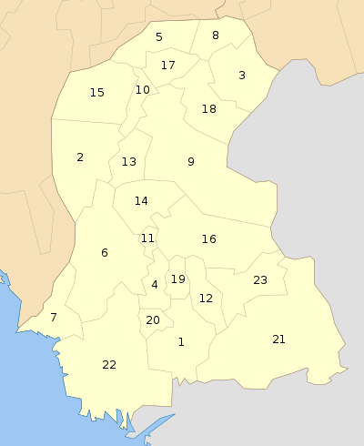
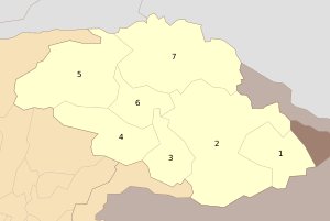
The provinces are subdivided into 34 divisions, which are subdivided into 149 districts called zillahs (Urdu: ضلع). Zillahs are further subdivided into 588 sub-districts called tehsils (تحصیل) (roughly equivalent to counties). The term tehsil is used everywhere except in Sindh province, where the term taluka (تعلقہ) predominates. Tehsils may contain villages or municipalities. Pakistan has over five thousand local governments. Since 2001, these have been led by democratically elected local councils, each headed by a nazim (ناظم) ("supervisor" or "mayor"). Women have been allotted a minimum of 33% of the seats on these councils. Some districts, incorporating large metropolitan areas, are called "City Districts". A City District may contain subdivisions called Towns and Union Councils.
The diagram below outlines the six tiers of government in Pakistan, together with an example.
| Federal government | |||||||||||||||||
| Province (e.g. Khyber Pakhtunkhwa) | |||||||||||||||||
| Division (e.g. Malakand Division) | |||||||||||||||||
| District (e.g. Malakand District) | |||||||||||||||||
| Tehsil/Town (e.g. Batkhela) | |||||||||||||||||
| Union Council (e.g. Middle Batkhela) | |||||||||||||||||
See also
- Divisions of Pakistan
- Local government in Pakistan
- Pakistani subnational abbreviations
- ISO 3166-2:PK
References
- ↑ "List of Districts, Tehsils/Talukas" (PDF). Pakistan Bureau of Statistics. July 2014. Retrieved 15 October 2016.
- ↑ History and Culture of Pakistan
- ↑ "Population shoots up by 47 percent since 1998". The News International. 2012-03-29. Retrieved 2015-07-30.
- ↑ "Area, Population, Density and Urban/Rural Proportion by Administrative Units". Population Census Organization, Government of Pakistan.
- ↑ https://www.iso.org/obp/ui/#iso:code:3166:PK
External links
- Government of Balochistan
- Government of Khyber Pakhtunkhwa
- Government of the Punjab
- Government of the Sindh
- Government of the Islamabad Capital Territory
- Government of the Federally Administered Tribal Areas
- Government of Azad Jammu and Kashmir
- Government of Gilgit-Baltistan
| ||||||||||||||||||||||||||||||||||||||||||||||
| ||||||||||||||||||||||||||||||||||||||||||||||
| ||||||||||||||||||||||||||||||||||||||||||||||
| ||||||||||||||||||||||||||||||||||||||||||||||
| ||||||||||||||||||||||||||||||||||||||||||||||
| ||||||||||||||||||||||||||||||||||||||||||||||
| ||||||||||||||||||||||||||||||||||||||||||||||
| ||||||||||||||||||||||||||||||||||||||||||||||


_Districts.svg.png)

| |||||||||||||||||||||||||||||||||
| |||||||||||||||||||||||||||||||||
| |||||||||||||||||||||||||||||||||
| |||||||||||||||||||||||||||||||||
| |||||||||||||||||||||||||||||||||
| |||||||||||||||||||||||||||||||||
| Provinces | ||
|---|---|---|
| Territories | ||
| Autonomous regions | ||
See also: Former administrative units of Pakistan | ||