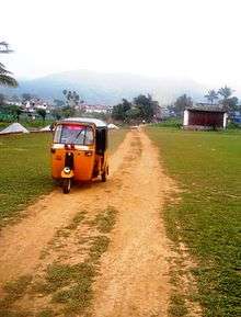
Devala, India

Bhajana Temple at School Road, Devala.
| Devala | |
|---|---|
| Village | |
| Nickname(s): Cherrapunji of the South, Second Cherrapunji | |
 Devala Location in Tamil Nadu, India | |
| Coordinates: 11°29′N 76°24′E / 11.483°N 76.400°ECoordinates: 11°29′N 76°24′E / 11.483°N 76.400°E | |
| Country |
|
| State | Tamil Nadu |
| District | Nilgiris |
| Population | |
| • Total | 600,000 approx |
| Languages | |
| • Official | Tamil |
| Time zone | IST (UTC+5:30) |
| PIN | 643270 |
| Telephone code | CODE04262 |
| Nearest city | Gudalur (Nilgiris district) |
| Literacy | 58% |
Devala is a town in the Nilgiris district of Tamil Nadu. It is situated at about 16 km from Gudalur on the Gudalur–Pandalur road. A stream originating from here flows to Kerala and reaches Maruthappuzha in Malappuram district of Kerala.
Tourism
Devala is a very scenic place with undulating tea estates and lush green villages. When it rains it pours here , that is the reason it is called the Cherrapunji of the South. Vetekorumagan Temple is a famous Temple here. There is no accommodation available in this little town. There are gold mines in Devala. It is a wonderful place.
Wild Planet is a famous resort which is situated in Devala,Nilgiris.
See also
- Pandallur town
- Mango Orange village

Mango Orange village near Devala
| Wikivoyage has a travel guide for Devala. |
This article is issued from Wikipedia - version of the 11/16/2016. The text is available under the Creative Commons Attribution/Share Alike but additional terms may apply for the media files.