Dhauliganga Dam
| Dhauliganga Dam | |
|---|---|
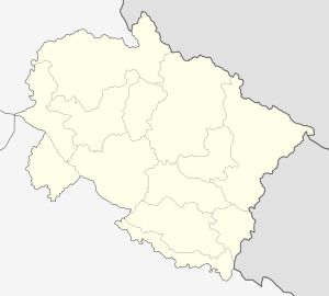 Location of Dhauliganga Dam in India Uttarakhand | |
| Country | India |
| Location | Uttarakhand |
| Coordinates | 29°58′42.6″N 80°34′19.2″E / 29.978500°N 80.572000°ECoordinates: 29°58′42.6″N 80°34′19.2″E / 29.978500°N 80.572000°E |
| Status | Operational |
| Construction cost | ₹15,800,000,000[1] |
| Owner(s) | National Hydroelectric Power Corporation Ltd |
| Dam and spillways | |
| Type of dam | Embankment, earth and rock-fill |
| Impounds | Dhauliganga River |
| Height | 56 m (184 ft) |
| Length | 315 m (1,033 ft) |
| Spillway type | Gate controlled |
| Reservoir | |
| Surface area | 8 km2 (3.1 sq mi) |
| Max. water depth | 70 m (230 ft) |
| Power station | |
| Type | Pumped-storage |
| Turbines | Vertical Francis turbines |
| Installed capacity | 280 MW |
The Dhauliganga Dam is a concrete face rock and earth-fill embankment dam on the Dhauliganga River near Dharchula in Uttarakhand, India, close to the borders with Tibet and Nepal. It was constructed by a joint venture of Kajima Construction Corporation, Ltd., and Daewoo Engineering & Construction with Bauer Maschinen. HRT & PH was constructed by JV of [HCC, Hindustan Construction Company] and Samsung Corporation [E&C] Group. It generates 280 MW of hydro power.
In June, 2013, there was an unprecedented flash flood, causing massive debris accumulation and the complete submergence of the power house. Damage caused electrical equipment replacement and loss of total generation capacity for more than six months.[2]
References
- ↑ "Dhauliganga I Hep Updated: December 2011". Infraline Energy. 29 December 2011. Retrieved 2012-10-14.
- ↑ http://sandrp.in/CurtainRaiserontheeventsatNHPCs280MWDhauligangaHEP.pdf
This article is issued from Wikipedia - version of the 11/12/2016. The text is available under the Creative Commons Attribution/Share Alike but additional terms may apply for the media files.