Điện Biên Phủ
| Điện Biên Phủ Thành phố Điện Biên Phủ | |
|---|---|
| Provincial capital | |
 | |
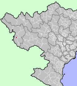 Location in northern Vietnam | |
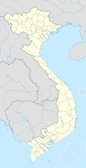 Điện Biên Phủ Location of Điện Biên Phủ in Vietnam | |
| Coordinates: 21°23′N 103°1′E / 21.383°N 103.017°E | |
| Country |
|
| Province | Điện Biên |
| Climate | Cwa |
Điện Biên Phủ (![]() listen) is a city in the north-west region of Vietnam. It is the capital of Điện Biên Province. The city is best known for the events which occurred there during the First Indochina War, the Battle of Điện Biên Phủ, during which the region was a breadbasket for the Việt Minh. The city was formerly called Thaeng.
listen) is a city in the north-west region of Vietnam. It is the capital of Điện Biên Province. The city is best known for the events which occurred there during the First Indochina War, the Battle of Điện Biên Phủ, during which the region was a breadbasket for the Việt Minh. The city was formerly called Thaeng.
Population
Statistics on Điện Biên Phủ's population vary depending on definitions—figures are generally between 70,000 and 125,000. The city is growing quickly, and is projected to have a population of 150,000 by 2020.[1] The majority of the population is not ethnically Vietnamese—rather, Thai ethnic groups form the largest segment. Ethnic Vietnamese make up around a third of the population, with the remainder being Hmong, Si La, or others.
Location within Vietnam
Điện Biên Phủ lies in Mường Thanh Valley, a 20-km-long and 6-km-wide basin sometimes described as "heart-shaped." It is on the western edge of Điện Biên Province, of which it is the capital, and is only a short distance from the border with Laos. Until the creation of the province in 2004, it was part of Lai Châu Province. The Vietnamese government elevated Điện Biên Phủ to town status in 1992, and to city status in 2003.
Transport
National route 12 connects Điện Biên to Lai Châu. Điện Biên Phủ Airport serves the city with air route to Hanoi.
History
The 8th century Thai locality of Muang Then is believed to have been centered here.
Operation Castor (1953)
In the 1950s, the town was known not only for its famous opium traffic, generating 500,000,000 French francs annually, but more so for a fierce battle that would result in a major realignment of world geopolitics. It was also an extensive source of rice for the Việt Minh.[2]
The region was fortified in November 1953 by the French Union force in the biggest airborne operation of the 1946-1954 First Indochina War, Operation Castor, to block Việt Minh transport routes and to set the stage to draw out Việt Minh forces.
Siege of Điện Biên Phủ (1954)
The following year, the important Battle of Điện Biên Phủ was fought between the Việt Minh (led by General Võ Nguyên Giáp), and the French Union (led by General Henri Navarre, successor to General Raoul Salan). The siege of the French garrison lasted fifty-seven days, from 17:30, 13 March to 17:30, 7 May 1954. The southern outpost or fire base of "Camp Isabelle" did not follow the cease-fire order and fought until 01:00. The long-scheduled Geneva Meeting's Indochina conference involving the United States, the UK, the French Union and the USSR had already begun on 26 April 1954[3][4]
The battle was significant beyond the valleys of Điện Biên Phủ. Giáp's victory ended major French involvement in Indochina and led to the accords which partitioned Vietnam into North and South.
See also
Notes
- ↑ Điện Biên Phủ: Development and Conservation in a Vietnamese Cultural Landscape, William Logan, 2005
- ↑ The Last Valley, Martin Windrow, 2004
- ↑ J. A. S. Grenville, page 407 The Collins History of the World in the Twentieth Century, ISBN 0 00 255169 1
- ↑ Forbes, Andrew, and Henley, David: Vietnam Past and Present: The North (History and culture of Hanoi and Tonkin). Chiang Mai. Cognoscenti Books, 2012. ASIN: B006DCCM9Q.
External links
| Wikimedia Commons has media related to Dien Bien Phu. |
Media links
- (French) The situation of Điện Biên Phủ, 50 years after the battle (French news, public channel France 2, 5 May 2004)Dinan Dinana inan
Coordinates: 21°23′N 103°01′E / 21.383°N 103.017°E
| Centrally-controlled municipalities |
| ||||||||||
|---|---|---|---|---|---|---|---|---|---|---|---|
| Provincial cities |
| ||||||||||
Capital: Điện Biên Phủ | ||
| Điện Biên Phủ | 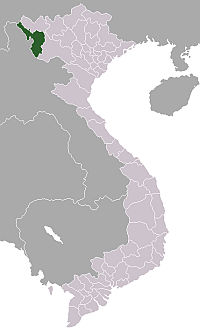 | |
| Mường Lay | ||
| Điện Biên | ||
| Điện Biên Đông | ||
| Mường Chà | ||
| Mường Nhé | ||
| Tủa Chùa | ||
| Tuần Giáo | ||
