Bát Xát District
| Bát Xát District Huyện Bát Xát | |
|---|---|
| Rural district | |
| Country |
|
| Region | Northeast |
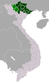
| Province | Lào Cai |
| Capital | Bát Xát |
| Area | |
| • Total | 410 sq mi (1,050 km2) |
| Population (2003) | |
| • Total | 62,477 |
| Time zone | UTC + 7 (UTC+7) |
Bát Xát is a rural district of Lào Cai Province in the Northeast region of Vietnam. As of 2003, the district had a population of 62,477.[1] The district covers an area of 1,050 km². The district capital lies at Bát Xát.[1]
Administrative divisions
Bát Xát, Cốc San, Tòng Sanh, Phìn Ngan, Quang Kim, Bản Qua,Mường Vị, Bản Vược, Bản Xèo, Pa Cheo, Nậm Pung, Trung Lènh Hồ, Mường Hum, Dền Thàng, Sáng Ma Sáo, Dền Sáng, Cốc Mỳ, Y Tý, Ngải Thầu, A Lù, A Mú Sung, Nậm Chạc,Trịnh Tường.
References
- 1 2 "Districts of Vietnam". Statoids. Archived from the original on 31 March 2009. Retrieved March 23, 2009.
Coordinates: 22°30′00″N 103°45′00″E / 22.500°N 103.750°E
This article is issued from Wikipedia - version of the 9/10/2016. The text is available under the Creative Commons Attribution/Share Alike but additional terms may apply for the media files.