Division of Dawson
| Dawson Australian House of Representatives Division | |
|---|---|
|
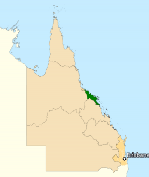
Division of Dawson in Queensland, as of the 2016 federal election. | |
| Created | 1949 |
| MP | George Christensen |
| Party | Liberal National |
| Namesake | Anderson Dawson |
| Electors | 103,654 (2016) |
| Area | 14,945 km2 (5,770.3 sq mi) |
| Demographic | Rural |
The Division of Dawson is an Australian Electoral Division in Queensland. The division was created in 1949 and is named after Anderson Dawson, the first Labor Premier of Queensland and leader of the first parliamentary socialist government anywhere in the world. It is located on the North Queensland coast, taking in the towns of Ayr, Bowen, Mackay, Proserpine and some south-eastern suburbs of the city of Townsville.
Apart from a period between 1966 to 1975 and 2007 to 2010, it has been held by the National Party. While Mackay, the largest city wholly within the electorate, is a longstanding Labor stronghold, it is not enough to overcome the region's overall conservative bent.
Members
| Member | Party | Term | |
|---|---|---|---|
| Charles Davidson | Country | 1949–1963 | |
| George Shaw | Country | 1963–1966 | |
| Rex Patterson | Labor | 1966–1975 | |
| Ray Braithwaite | National | 1975–1996 | |
| De-Anne Kelly | National | 1996–2007 | |
| James Bidgood | Labor | 2007–2010 | |
| George Christensen | Liberal National | 2010–present | |
Election results
Main article: Electoral results for the Division of Dawson
| Party | Candidate | Votes | % | ± | |
|---|---|---|---|---|---|
| Liberal National | George Christensen | 38,474 | 42.61 | −3.62 | |
| Labor | Frank Gilbert | 29,608 | 32.79 | +3.08 | |
| Katter's Australian | Ash Dodd | 5,904 | 6.54 | −0.20 | |
| Greens | Jonathon Dykyj | 4,652 | 5.15 | +0.13 | |
| Independent | Steven Large | 4,184 | 4.63 | +4.63 | |
| Glenn Lazarus Team | Michael Hall | 4,075 | 4.51 | +4.51 | |
| Family First | Amanda Nickson | 3,403 | 3.77 | +1.87 | |
| Total formal votes | 90,300 | 95.45 | +0.30 | ||
| Informal votes | 4,309 | 4.55 | −0.30 | ||
| Turnout | 94,609 | 91.27 | −2.55 | ||
| Two-party-preferred result | |||||
| Liberal National | George Christensen | 48,167 | 53.34 | −4.24 | |
| Labor | Frank Gilbert | 42,133 | 46.66 | +4.24 | |
| Liberal National hold | Swing | −4.24 | |||
References
- ↑ Dawson, QLD, Virtual Tally Room 2016, Australian Electoral Commission.
External links
Coordinates: 20°12′14″S 148°00′11″E / 20.204°S 148.003°E
This article is issued from Wikipedia - version of the 11/24/2016. The text is available under the Creative Commons Attribution/Share Alike but additional terms may apply for the media files.